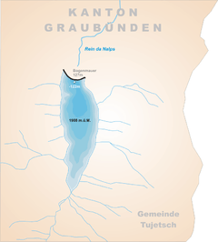
Lai da Nalps
| Lai da Nalps | |
|---|---|
 map | |
| Location | Grisons |
| Coordinates | 46°37′57″N 8°45′48″E / 46.63250°N 8.76333°ECoordinates: 46°37′57″N 8°45′48″E / 46.63250°N 8.76333°E |
| Type | reservoir |
| Catchment area | 22.3 km2 (8.6 sq mi) |
| Basin countries | Switzerland |
| Max. length | 2.0 km (1.2 mi) |
| Surface area | 0.91 km2 (0.35 sq mi) |
| Max. depth | 122 m (400 ft) |
| Water volume | 45 million cubic metres (36,000 acre⋅ft) |
| Surface elevation | 1,908 m (6,260 ft) |
Lai da Nalps is a reservoir in the municipality of Tujetsch, Grisons, Switzerland. It has a capacity of 45 million m³ and a surface area of 0.91 km². The reservoir is connected to Lai da Sontga Maria and Lai da Curnera in neighboring valleys.
External links

This article is issued from
Wikipedia.
The text is licensed under Creative Commons - Attribution - Sharealike.
Additional terms may apply for the media files.