Chungará Lake
| Lake Chungará | |
|---|---|
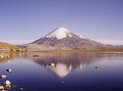 Lake and Parinacota Volcano | |
| Location | Arica y Parinacota Region, Chile |
| Coordinates | 18°15′S 69°09′W / 18.250°S 69.150°WCoordinates: 18°15′S 69°09′W / 18.250°S 69.150°W |
| Primary inflows | Chungará, Sopocalane |
| Basin countries | Chile |
| Surface area | 21.5 square kilometres (8.3 sq mi) |
| Max. depth | 33 metres (108 ft) |
| Surface elevation | 4,517 metres (14,820 ft) |
Chungará (hispanicized spelling of Aymara chunkara "pointed mountain")[1] is a lake situated in the extreme north of Chile, in the Altiplano of Arica y Parinacota Region in the Lauca National Park. It is the 31st highest lake in the world (and the 12th highest in South America).[2] It is near the volcanos Parinacota (20,827 ft or 6,348 m) and Pomerape (20,413 ft or 6,222 m).[3] It was formed 8000 years ago, when a major collapse of the edifice of Parinacota produced an avalanche of 6 km³ of debris which blocked drainage pattern, thus creating the lake.
The pencil catfish Trichomycterus chungarensis and the pupfish Orestias chungarensis are endemic to the lake basin.
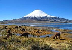 Vicuñas at Chungará Lake
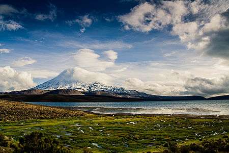 Parinacota Volcano and Lake Chungará
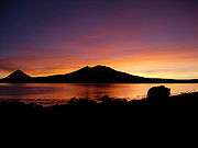 Morning on Chungará Lake.
See also
References
| Wikimedia Commons has media related to Lake Chungará. |
- ↑ "Diccionario Bilingüe Castellano-Aymara 2002". Félix Laime Pairumani. Archived from the original on September 23, 2015. Retrieved January 14, 2015.
- ↑
- ↑ "Archived copy". Archived from the original on 2006-04-05. Retrieved 2006-03-31.
| Rivers |
| |
|---|---|---|
| Lakes | ||
This article is issued from
Wikipedia.
The text is licensed under Creative Commons - Attribution - Sharealike.
Additional terms may apply for the media files.