Lady's Holm
| Gaelic name | Unknown |
|---|---|
| Norse name | Unknown |
| Meaning of name | na |
| Location | |
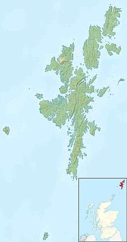 Lady's Holm Lady's Holm shown within Scotland | |
| OS grid reference | HU3757409715 |
| Coordinates | 59°52′17″N 1°19′44″W / 59.871389°N 1.328889°W |
| Physical geography | |
| Island group | Shetland |
| Area rank | na [1] |
| Highest elevation | 21 m |
| Administration | |
| Sovereign state | United Kingdom |
| Country | Scotland |
| Council area | Shetland |
| Demographics | |
| Population | uninhabited |
Lady's Holm is an island off southern Mainland in the Shetland Islands.[2] It is not to be confused with the Maiden Stack, which is also known as "Frau Stack"
It is to the west of Scat Ness and the village of Scatness, a headland on Mainland, and there is also another islet nearby, Little Holm.
Sumburgh Airport is about a mile northeast.
It is 21 metres (69 ft) at its highest point, which is marked by a cairn.[2]
It was traditionally used for grazing sheep.[2] Grey seals also inhabit the island and they were badly affected by the oil spill from the MV Brear in 1993.[3]
In 1942, a Bristol Blenheim Mk IV bomber of the RCAF crashed off Lady's Holm.[4]
References
- ↑ Area and population ranks: there are c. 300 islands over 20 ha in extent and 93 permanently inhabited islands were listed in the 2011 census.
- 1 2 3 Shetlopedia article
- ↑ Hall, Ailsa J.; Watkins, John; Hiby, Lex (1996-07-16). "The impact of the 1993 Braer oil spill on grey seals in Shetland". Science of the Total Environment. Marine Mammals And The Marine Environment. 186 (1–2): 119–125. doi:10.1016/0048-9697(96)05090-5.
- ↑ "Shetland underwater crash sites - Blenheim IV T1949 404 (RCAF) Sq 06/10/1942 Off Lady`s Holm". Aviation Research Group Orkney & Shetland. Retrieved 2016-05-21.
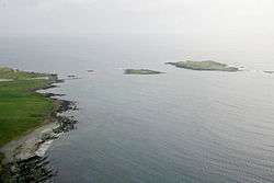
Aerial view of Lady's Holm (right) and Little Holm (centre)
Coordinates: 59°52′17″N 1°19′44″W / 59.87139°N 1.32889°W
This article is issued from
Wikipedia.
The text is licensed under Creative Commons - Attribution - Sharealike.
Additional terms may apply for the media files.