La Plata River (San Juan River tributary)
| La Plata River[1] | |
|---|---|
 | |
| Physical characteristics | |
| Main source | 37°27′23″N 108°02′04″W / 37.45639°N 108.03444°W |
| River mouth |
Confluence with San Juan 5,213 ft (1,589 m) 36°44′10″N 108°15′06″W / 36.73611°N 108.25167°WCoordinates: 36°44′10″N 108°15′06″W / 36.73611°N 108.25167°W |
| Basin features | |
| Progression | San Juan—Colorado |
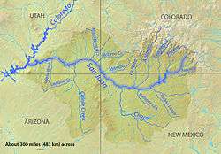
La Plata River (Navajo: Tsé Dogoi Ńlíní) is a 70-mile-long (110 km)[2] tributary to the San Juan River in La Plata County, Colorado, and San Juan County, New Mexico, United States. This small river heads at the western foot of Snow Storm Peak in the La Plata Mountains of southwestern Colorado, approximately 35 miles north of the New Mexico state line. It flows in a southerly direction until it joins the San Juan at the western edge of the city of Farmington, New Mexico, about 19 miles south of the Colorado state line.
The Navajo name for the river, Tsé Dogoi Nlini translates as "flowing over projecting rock".[3]
See also
References
- ↑ "La Plata River". Geographic Names Information System. United States Geological Survey. Retrieved 2011-01-29.
- ↑ "The National Map". U.S. Geological Survey. Archived from the original on 2012-04-05. Retrieved Feb 11, 2011.
- ↑ Linford, Laurance D. (2000). Navajo Places - History, Legend Landscape. Salt Lake City: The University of Utah Press. ISBN 0-87480-624-0.
This article is issued from
Wikipedia.
The text is licensed under Creative Commons - Attribution - Sharealike.
Additional terms may apply for the media files.