La Esmeralda, Venezuela
| La Esmeralda | |
|---|---|
.svg.png) La Esmeralda | |
| Coordinates: 3°10′26″N 65°32′48″W / 3.17389°N 65.54667°WCoordinates: 3°10′26″N 65°32′48″W / 3.17389°N 65.54667°W | |
| Country |
|
| State | Amazonas State |
| Municipality | Alto Orinoco Municipality |
| Founded | 1758 |
| Elevation | 225 m (738 ft) |
| Population (2013) | |
| • Total | 20 030 |
| Time zone | VST |
| Climate | Af |
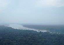
Orinoco river crossing La Esmeralda
La Esmeralda is a small settlement in and the capital of Alto Orinoco Municipality in Venezuela’s Amazonas State. The name means “the emerald”. It is located on the shore of the Orinoco river, only 9 miles from the Casiquiare canal bifurcation that links it to the Amazon River.
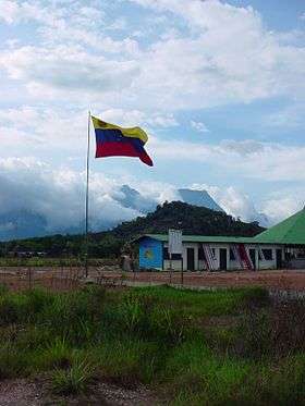
The settlement contains about a hundred homes, a school, an airfield and a military outpost.
References
External links
La Esmeralda Mercal
This article is issued from
Wikipedia.
The text is licensed under Creative Commons - Attribution - Sharealike.
Additional terms may apply for the media files.