Lácar Lake
| Lácar Lake | |
|---|---|
 | |
| Location | Lácar Department, Neuquén Province |
| Coordinates | 40°11′S 71°32′W / 40.183°S 71.533°WCoordinates: 40°11′S 71°32′W / 40.183°S 71.533°W |
| Type | glacial lake |
| Primary outflows | Huahum River |
| Catchment area | 1,048 km2 (405 sq mi) |
| Basin countries | Argentina |
| Surface area | 55 km2 (21 sq mi) |
| Average depth | 167 m (548 ft) |
| Max. depth | 277 m (909 ft) |
| Surface elevation | 630 m (2,070 ft) |
| Settlements | San Martín de los Andes |
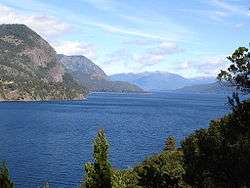
The Lácar Lake (Spanish: Lago Lácar) is a lake of glacial origin in Neuquén Province, Argentina. It is enclosed in a mountain range of the Andes, at 630 m above mean sea level, approximately at 40°11′S 71°32′W / 40.183°S 71.533°W. The area around the lake is mostly uninhabited, except for the small city of San Martín de los Andes on its northeastern coast.
The lake has a surface area of 55 km² and a mean depth of 167 m, with a maximum of 277 m. Its catchment basin comprises 1,048 km². Like many Andean Argentine lakes, it drains across Chile and into the Pacific Ocean, in this case via the Huahum River that flows through Huahum Pass in the Andes.
As the northernmost lake on the eastern side of Andes that drains to the Pacific the lake and his catchment basin was claimed by Chile until 1902 based on an interpretation of the Boundary treaty of 1881 between Chile and Argentina.
Gallery
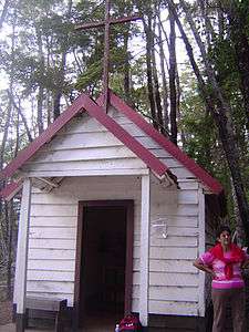 A chapel in Santa Teresita island in Lake Lácar
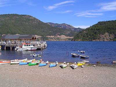 The Lake Lácar coast
References
External links