Kunerad
| Kunerad | |
| Municipality | |
 | |
| Country | Slovakia |
|---|---|
| Region | Žilina |
| District | Žilina |
| Elevation | 494 m (1,621 ft) |
| Coordinates | 49°05′57″N 18°42′38″E / 49.09917°N 18.71056°ECoordinates: 49°05′57″N 18°42′38″E / 49.09917°N 18.71056°E |
| Area | 22.94 km2 (8.86 sq mi) |
| Population | 931 |
| Density | 41/km2 (106/sq mi) |
| Postal code | 013 13 |
| Area code | +421-41 |
| Car plate | ZA |
  Location of Kunerad in Slovakia | |
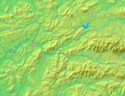  Location of Kunerad in the Žilina Region | |
| Wikimedia Commons: Kunerad | |
| Website: www.obeckunerad.sk | |
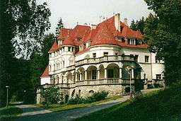
Kunerad is a village and municipality in Žilina District in the Žilina Region of northern Slovakia.
History
In historical records the village was first mentioned in 1490.
Geography
The municipality lies at an altitude of 494 metres and covers an area of 22.937km². It has a population of about 931 people.
External links
This article is issued from
Wikipedia.
The text is licensed under Creative Commons - Attribution - Sharealike.
Additional terms may apply for the media files.