Kozhuh Peak
Kozhuh Peak (Bulgarian: връх Кожух, ‘Vrah Kozhuh’ \'vr&h 'ko-zhuh\) is the ice-covered peak rising to 1250 m on the west side of Elgar Uplands, northern Alexander Island in Antarctica. It surmounts Delius Glacier to the north and Bartók Glacier to the south-southwest.
The feature is named after the extinct volcano of Mount Kozhuh in Southwestern Bulgaria.
Location
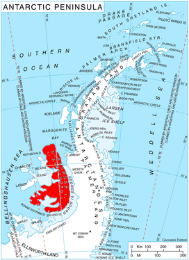
Kozhuh Peak is located at 69°40′42″S 70°55′17″W / 69.67833°S 70.92139°WCoordinates: 69°40′42″S 70°55′17″W / 69.67833°S 70.92139°W, which is 9.26 km north-northwest of Mount Pinafore, 8.92 km northeast of Appalachia Nunataks and 19.1 km southeast of Shaw Nunatak. British mapping in 1971.
Maps
- British Antarctic Territory. Scale 1:200000 topographic map. DOS 610 – W 69 70. Tolworth, UK, 1971
- Antarctic Digital Database (ADD). Scale 1:250000 topographic map of Antarctica. Scientific Committee on Antarctic Research (SCAR). Since 1993, regularly upgraded and updated
References
- Bulgarian Antarctic Gazetteer. Antarctic Place-names Commission. (details in Bulgarian, basic data in English)
- Kozhuh Peak. SCAR Composite Gazetteer of Antarctica
This article includes information from the Antarctic Place-names Commission of Bulgaria which is used with permission.