Askøyfjellet
| Askøyfjellet | |
|---|---|
| Kolbeinsvarden | |
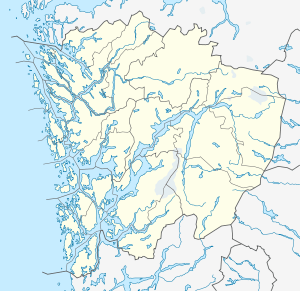
 Askøyfjellet Location in Hordaland | |
| Highest point | |
| Elevation | 231 m (758 ft) |
| Prominence | 231 metres (758 ft) |
| Coordinates | 60°26′16″N 05°12′43″E / 60.43778°N 5.21194°ECoordinates: 60°26′16″N 05°12′43″E / 60.43778°N 5.21194°E |
| Geography | |
| Location | Hordaland, Norway |
| Topo map | 1115 I Bergen |
| Climbing | |
| Easiest route | Hiking |
Askøyfjellet or Kolbeinsvarden is a mountain in the municipality of Askøy in Hordaland county, Norway. The 231-metre (758 ft) tall mountain lies near the southeastern coast of the island of Askøy, just north of Kleppestø. The mountain is traditionally considered to be one of De syv fjell (the seven mountains) surrounding the city of Bergen.[1]
References
- ↑ Store norske leksikon. "Askøy" (in Norwegian). Retrieved 2014-11-06.
This article is issued from
Wikipedia.
The text is licensed under Creative Commons - Attribution - Sharealike.
Additional terms may apply for the media files.