Klostertaler Gscheid
| Klostertaler Gscheid | |
|---|---|
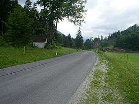 Klostertaler Gscheid with Chapel | |
| Elevation | 764 m (2,507 ft) |
| Traversed by | Road |
| Location | Austria |
| Coordinates | 47°48′36″N 15°48′01″E / 47.81000°N 15.80028°ECoordinates: 47°48′36″N 15°48′01″E / 47.81000°N 15.80028°E |
 Klostertaler Gscheid Location of Klostertaler Gscheid | |
The Klostertaler Gscheid is a 764 m (AA) high mountain pass in southern Lower Austria, which links the Klostertal valley (municipality of Gutenstein) with the valley of the River Voisbach (municipality of Schwarzau im Gebirge). At the summit of the pass is a small chapel. A tarmac state road (Landesstraße) runs over the pass. The road runs from northeast to southwest along the northern slopes of the Schneeberg. Because of the sparse population of the region the pass only is only of local significance. It is not closed in winter.
See also
| ||
This article is issued from
Wikipedia.
The text is licensed under Creative Commons - Attribution - Sharealike.
Additional terms may apply for the media files.