Ballydesmond
| Ballydesmond Baile Deasumhan | |
|---|---|
| Village | |
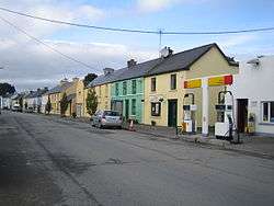 Main Street | |
 Ballydesmond Location in Ireland | |
| Coordinates: 52°11′N 9°14′W / 52.183°N 9.233°W | |
| Country | Ireland |
| Province | Munster |
| County | County Cork |
| Population (2016)[1] | |
| • Total | 210 |
Ballydesmond (Irish: Baile Deasumhan), formerly Kingwilliamstown, is a rural village in County Cork, Ireland. It is alongside the Blackwater River (near its source in Menganine) on the Cork-Kerry border. The Ballydesmond quarry is an area of geological interest, containing the best example of tundra forest polygons found in Ireland.[2]
It is located at the junction of the R577 and R578 regional roads.
History
Ballydesmond was established in the 1830s as a model village, and named Kingwilliamstown after King William IV of the United Kingdom. It had formerly been known as Tooreenkeogh.[3] In 1951, it was officially renamed Ballydesmond, an anglicisation of the Irish name Baile Deasumhan.[4] This is thought to refer to legendary freedom fighter, the 15th Earl of Desmond, who is believed to have taken refuge in the nearby hills. However, Kingwilliamstown remained the official name of the townland.
Daniel Buckley, Hannah Riordan and Bridget Delia Bradley from Ballydesmond survived the sinking of the RMS Titanic.[5][6][7]
The Tureengarriffe ambush occurred near Ballydesmond, where a number of British army officers were killed during the Irish War of Independence by untrained members of the local flying column of the Irish Republican Army. Nora Herlihy, a founder member of the Irish League of Credit Unions, is from Ballydesmond.[8]
Local economy
Ballydesmond has a thriving economy based on small local businesses. Bob's Bar, which was opened until the late 1990s, was re-opened in 2006. A new restaurant was added also on the first floor. A take-away was then opened on 2 April 2010. Ballydesmond is also home to the international company – Munster Joinery.
Transport and communications
The village is located on what was formerly the main Cork-to-Tralee road. The village centre is on the R577 regional road where it is joined by the R578 from the north and just west of where it is joined by the R582 from the south, and is about 45 kilometres west of Mallow, 17 kilometres west of Newmarket and 20 kilometres east of Castleisland, County Kerry.
There is an eircom telecom exchange sits in the centre of the village. Ballydesmond is one of the few villages in County Cork to avail of DSL broadband services.[9] Sliabh Luachra TV, a local community-run deflector service, ran from Ballydesmond from the early 1990s to 2009.
Education
There are two primary schools in the parish. Ballydesmond National School sits beside the local church, overlooking the village. Foilogohig National School, or "Foyle" as it is locally known, used to operate in North Ballydesmond, catering for students who live a long distance from the village. There is also a crèche in Ballydesmond. Foilogohig N.S closed at the end of the 2008–2009 school year as there was insufficient numbers for the school to remain open. Ballydesmond N.S. got an internal refurbishment in 2010.
Culture
Ballydesmond lies in the Sliabh Luachra area which is famed for its traditional Irish music and culture. There is the Sliabh Luachra Bar (John D's) in the village.
See also
References
- ↑ "Census 2016 Sapmap Area: Settlements Ballydesmond". Central Statistics Office (Ireland). Retrieved 12 August 2018.
- ↑ Chapter 3 Archived 10 September 2014 at the Wayback Machine.. (PDF) . corkcoco.ie. Retrieved on 23 April 2012.
- ↑ MacLysaght, Edward (1960). More Irish families. O'Gorman. p. 87.
- ↑ S.I. No. 138/1951 — Local Government (Change of Name of Townland) Order, 1951. Irish Statute Book.
- ↑ Mr Daniel Buckley. Encyclopedia-titanica.org. Retrieved on 23 April 2012.
- ↑ Miss Hannah Riordan. Encyclopedia-titanica.org. Retrieved on 30 April 2018.
- ↑ Miss Bridget Delia Bradley. Encyclopedia-titanica.org. Retrieved on 23 April 2012.
- ↑ Nora Herlihy. Ilcu.ie. Retrieved on 23 April 2012.
- ↑ Broadband A-Z map of Cork, including Ballydesmond's status. Broadbandatoz.ie (24 February 2011). Retrieved on 23 April 2012.