Kamitonda, Wakayama
| Kamitonda 上富田町 | |||
|---|---|---|---|
| Town | |||
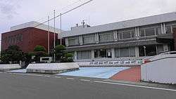 Kamitonda town office | |||
| |||
 Location of Kamitonda in Wakayama Prefecture | |||
 Kamitonda Location in Japan | |||
| Coordinates: 33°42′N 135°26′E / 33.700°N 135.433°ECoordinates: 33°42′N 135°26′E / 33.700°N 135.433°E | |||
| Country | Japan | ||
| Region | Kansai | ||
| Prefecture | Wakayama Prefecture | ||
| District | Nishimuro | ||
| Area | |||
| • Total | 57.49 km2 (22.20 sq mi) | ||
| Population (October 1, 2016) | |||
| • Total | 15,047 | ||
| • Density | 260/km2 (680/sq mi) | ||
| Time zone | UTC+9 (JST) | ||
| Website |
www | ||


Kamitonda (上富田町 Kamitonda-chō) is a town located in Nishimuro District, Wakayama Prefecture, Japan.
As of 2016, the town has an estimated population of 15,047 and a density of 260 persons per km². The total area is 57.49 km².
Kamitonda has participated in the JET Programme since at least 2000.
Kamitonda is located between the city of Tanabe and the beach-town of Shirahama. It is surrounded by mountains and is divided into 5 districts: Asso, Iwada, Ikuma, Oka and Ichinose. The most populated is Asso.
A celebrated town event is the KuchiKumano Marathon which takes place every year in early February. Runners from all over the world and all over Japan come to participate in this beautiful race. One can run 5 kilometers, half a Marathon, or a full Marathon.
The Mayor is currently Mr. Koide, who took office in 2003.
The town has 5 elementary schools, one major Junior High School with a total student body of 450 students, and one High School.
External links

- Kamitonda official website (in Japanese)