Kızılpınar, Çerkezköy
| Kızılpınar | |
|---|---|
| Neighborhood | |
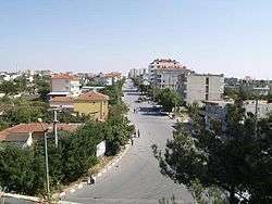 Hürriyet Street (2009) | |
 Kızılpınar Location in Turkey | |
| Coordinates: 41°16′N 27°58′E / 41.267°N 27.967°ECoordinates: 41°16′N 27°58′E / 41.267°N 27.967°E | |
| Country |
|
| Region | Marmara |
| Province | Tekirdağ Province |
| District | Çerkezköy |
| Elevation | 150 m (490 ft) |
| Population (2017) | |
| • Total | 34,384 |
| Time zone | UTC+2 (EET) |
| • Summer (DST) | UTC+3 (EEST) |
| Postal code | 59530 |
| Area code | 0282 |
| Licence plate | 59 |
| Website | www.cerkezkoy.bel.tr |
.jpg)
Kızılpınar is a neighborhood in Çerkezköy district of Tekirdağ Province, Turkey. At 41°16′N 27°58′E / 41.267°N 27.967°E it is almost merged to Çerkezköy. Distance to Tekirdağ is about 55 kilometres (34 mi). The population of Kızılpınar is 34,384 [1] as of 2017. The neighborhood was founded by Muslim refugees from Bulgaria during the Russo-Turkish War (1877-1878). According to Mayor’s page some members of Malkoçoğlu Family of the Ottoman Empire were among these refugees.
References
- ↑ "Turkstat". Turkish Statistical Institute. Retrieved 13 February 2018.
External links
- Tekirdağ Governor's Official Website
- Metropolitan Municipality of Tekirdağ
- District municipality's Official Website
This article is issued from
Wikipedia.
The text is licensed under Creative Commons - Attribution - Sharealike.
Additional terms may apply for the media files.