Jealott's Hill
| Jealott's Hill | |
|---|---|
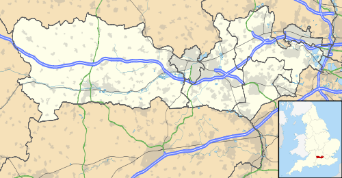 Jealott's Hill Jealott's Hill shown within Berkshire | |
| OS grid reference | SU871735 |
| Metropolitan borough | |
| Metropolitan county | |
| Region | |
| Country | England |
| Sovereign state | United Kingdom |
| Post town | Bracknell |
| Postcode district | RG42 |
| Dialling code | 01344 |
| Police | Thames Valley |
| Fire | Royal Berkshire |
| Ambulance | South Central |
| EU Parliament | South East England |
| UK Parliament | |
Jealott's Hill is a village in the county of Berkshire, England,[1] within the civil parish of Warfield.[2] The settlement is on the A3095 road approximately 3 miles (5 km) north of Bracknell. The nearest railway station is in Bracknell. The name of the hill is reported[3] to have derived from the surname of a 14th century landowner, Roger Jolyl. This name evolved into "Joyliff's Hill" and then, on Henry Walter's Map of Windsor Forest, 1823,[4] became "Jealous Hill". This changed again to "Jealot's Hill" on John Snare's 1846 map[5] and by the 1920s the modern spelling was established.[3]
Syngenta research site
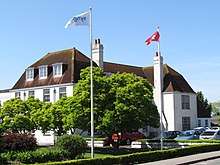

Jealott's Hill is home to Syngenta's largest research and development site which includes a large agricultural research greenhouse at 4,000 square metres (43,000 sq ft) and a 260 ha (640-acre) farm. As of 2018, Syngenta employed around 800 people there.[6] The site was formed in 1927 by the amalgamation of three farms, Hawthorndale, Nuptown and Jealott's Hill itself. Jealott's Hill House was built in 1928 and officially opened on 28 June 1929 as the offices, laboratory and library of Imperial Chemical Industries's Agricultural Research Station; initially the research focused on nitrogen fertilizers in grassland management. In 1936, the Hawthorndale Biological Laboratories were opened in the converted mansion building of the former farm. Research there involved the biological evaluation of chemicals as potential pesticides.[3] The site is now called Jealott's Hill International Research Centre.[6]
References
- ↑ Ordnance Survey: Landranger map sheet 175 Reading & Windsor (Henley-on-Thames & Bracknell) (Map). Ordnance Survey. 2012. ISBN 9780319232149.
- ↑ "Ordnance Survey Election Maps". www.ordnancesurvey.co.uk. Ordnance Survey. Retrieved 3 April 2016.
- 1 2 3 Peacock, F.C. (1978). "Chapter 1: Introduction". In Peacock, F.C. Jealott's Hill: Fifty years of Agricultural Research 1928-1978. Imperial Chemical Industries Ltd. pp. 1–9. ISBN 0901747017.
- ↑ Walter, Henry (1823). "A Map Of Windsor Forest And Its Vicinity". Retrieved 18 May 2018.
- ↑ Snare, John (1846). Snare's Map of the Country ten miles round Reading. OCLC 557234239.
- 1 2 Syngenta. "Jealott's Hill". www.syngenta.co.uk. Retrieved 7 April 2018.
External links
| Wikimedia Commons has media related to Jealott's Hill International Research Station. |