Jøkulkyrkja Mountain
| Jøkulkyrkja Mountain | |
|---|---|
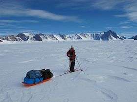 Jøkulkyrkja seen from the east. The top is behind what seems like the highest point to the right. | |
| Highest point | |
| Elevation | 3,148 m (10,328 ft) [1] |
| Coordinates | 71°53′S 6°40′E / 71.883°S 6.667°ECoordinates: 71°53′S 6°40′E / 71.883°S 6.667°E |
| Geography | |
| Location | Princess Astrid Coast, Queen Maud Land, East Antarctica |
| Parent range | Mühlig-Hofmann Mountains |
| Climbing | |
| Easiest route | basic snow/ice climb |
Jøkulkyrkja Mountain ("the Glacier Church"), also known as Massiv Yakova Gakkelya, is a broad, ice-topped mountain with several radial rock spurs, standing east of Lunde Glacier in the Mühlig-Hofmann Mountains of Queen Maud Land, East Antarctica. [2] At 3,148 metres (10,328 ft) elevation, it is the highest elevation in Queen Maud Land, and also the highest elevation within the claims of Norway.[1] The mountain is located on the Princess Astrid Coast of the Norwegian Antarctic Territory. Håhellerskarvet ("shark cave mountain"), 2,910 metres (9,550 ft), is located to the southwest; the two peaks are separated by the 25-mile-long Lunde Glacier, which flows to the northwest.
Discovery and naming
Jøkulkyrkja Mountain was plotted from surveys and air photos by the Sixth Norwegian Antarctic Expedition (1956–60) and named Jøkulkyrkja.[2] The first element is jøkul m 'small glacier', the last element is the finite form of kyrkje f 'church'. (Like other names in the Norwegian Arctic and Antarctic islands and areas the Nynorsk form of Norwegian is used in the name - the Bokmål form would have been "Jøkelkirken").
Mountaineering significance
The first ascent of Jøkulkyrkja Mountain was in January 1994, by a team of 13 mountain climbers led by Ivar Tollefsen. The first woman to reach the top was Merete Asak, November 2010.
See also
References
- 1 2 Birgit Njåstad: «Antarktis - norsk natur- og kulturminneforvaltning» Rapportserie No. 112, Norwegian Polar Institute, Tromsø 1999, p. 17 (in Norwegian)
- 1 2 "Jøkulkyrkja Mountain". Geographic Names Information System. United States Geological Survey. Retrieved 2013-04-26.
External links
![]()