Island City, Oregon
| Island City, Oregon | |
|---|---|
| City | |
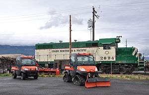 Locomotive and other vehicles near Island Avenue | |
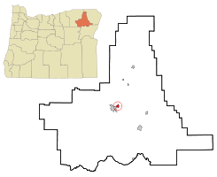 Location in Oregon | |
| Coordinates: 45°20′19″N 118°2′50″W / 45.33861°N 118.04722°WCoordinates: 45°20′19″N 118°2′50″W / 45.33861°N 118.04722°W | |
| Country | United States |
| State | Oregon |
| County | Union |
| Incorporated | 1904 |
| Government | |
| • Mayor | Delmer E. Hanson |
| Area[1] | |
| • Total | 0.98 sq mi (2.54 km2) |
| • Land | 0.98 sq mi (2.54 km2) |
| • Water | 0 sq mi (0 km2) |
| Elevation | 2,743 ft (836 m) |
| Population (2010)[2] | |
| • Total | 989 |
| • Estimate (2012[3]) | 997 |
| • Density | 1,009.2/sq mi (389.7/km2) |
| Time zone | UTC-8 (Pacific) |
| • Summer (DST) | UTC-7 (Pacific) |
| ZIP code | 97850 |
| Area code(s) | 458 and 541 |
| FIPS code | 41-36750[2] |
| GNIS feature ID | 1164106[4] |
Island City is a city in Union County, Oregon, United States. Its name originated from the city's location on an island between the Grande Ronde River and a nearby slough. However, the slough was later diverted, removing the city's island status. The population was 989 at the 2010 census.
Geography
Island City lies at the intersection of Oregon Route 82 and Oregon Route 237 on the northeastern outskirts of La Grande.[5] According to the United States Census Bureau, the city has a total area of 0.98 square miles (2.54 km2), all land.[1]
Demographics
| Historical population | |||
|---|---|---|---|
| Census | Pop. | %± | |
| 1910 | 166 | — | |
| 1920 | 141 | −15.1% | |
| 1930 | 116 | −17.7% | |
| 1940 | 177 | 52.6% | |
| 1950 | 138 | −22.0% | |
| 1960 | 158 | 14.5% | |
| 1970 | 202 | 27.8% | |
| 1980 | 477 | 136.1% | |
| 1990 | 696 | 45.9% | |
| 2000 | 916 | 31.6% | |
| 2010 | 989 | 8.0% | |
| Est. 2016 | 1,016 | [6] | 2.7% |
| U.S. Decennial Census[7] | |||
2010 census
At the 2010 census, there were 989 people, 399 households and 298 families residing in the city. The population density was 1,009.2 inhabitants per square mile (389.7/km2). There were 416 housing units at an average density of 424.5 per square mile (163.9/km2). The racial make-up was 94.7% White, 0.1% African American, 0.6% Native American, 0.5% Asian, 0.8% Pacific Islander, 0.9% from other races, and 2.3% from two or more races. Hispanic or Latino of any race were 3.4% of the population.[2]
There were 399 households of which 29.6% had children under the age of 18 living with them. 62.2% were married couples living together, 10.0% had a female householder with no husband present, 2.5% had a male householder with no wife present and 25.3% were non-families. 21.3% of all households were made up of individuals and 10.8% had someone living alone who was 65 years of age or older. The average household size was 2.45 and the average family size was 2.81.[2]
The median age was 43.5 years. 23.8% of residents were under the age of 18; 6.2% were between the ages of 18 and 24; 22.4% were from 25 to 44; 27.3% were from 45 to 64; and 20.6% were 65 years of age or older. The gender make-up was 49.4% male and 50.6% female.[2]
2000 census
At the 2000 census, there were 916 people, 357 households and 280 families residing in the city. The population density was 1,055.3 per square mile (406.5/km²). There were 375 housing units at an average density of 432.0 per square mile (166.4/km²). The racial make-up was 95.41% White, 0.22% African American, 1.20% Native American, 0.76% Asian, 0.33% Pacific Islander, 1.09% from other races, and 0.98% from two or more races. Hispanic or Latino of any race were 2.07% of the population.[2]
There were 357 households of which 31.9% had children under the age of 18 living with them, 70.6% were married couples living together, 6.4% had a female householder with no husband present, and 21.3% were non-families. 17.9% of all households were made up of individuals and 9.2% had someone living alone who was 65 years of age or older. The average household size was 2.57 and the average family size was 2.87.[2]
23.7% of the population were under the age of 18, 7.1% from 18 to 24, 24.7% from 25 to 44, 28.2% from 45 to 64, and 16.4% who were 65 years of age or older. The median age was 42 years. For every 100 females, there were 98.3 males. For every 100 females age 18 and over, there were 94.2 males.[2]
The median household income was $43,977 and the median family income was $49,327. Males had a median income of $39,250 and females $20,486. The per capita income was $19,138. About 3.3% of families and 5.9% of the population were below the poverty line, including 3.9% of those under age 18 and 9.3% of those age 65 or over.[2]
References
- 1 2 "US Gazetteer files 2010". United States Census Bureau. Archived from the original on July 14, 2012. Retrieved December 21, 2012.
- 1 2 3 4 5 6 7 8 9 "American FactFinder". United States Census Bureau. Retrieved 2012-12-21.
- ↑ "Population Estimates". United States Census Bureau. Archived from the original on June 17, 2013. Retrieved June 2, 2013.
- ↑ "US Board on Geographic Names". United States Geological Survey. October 25, 2007. Retrieved January 31, 2008.
- ↑ Oregon Road & Recreation Atlas (5th ed.). Santa Barbara, California: Benchmark Maps. 2012. p. 55. ISBN 978-0-929591-62-9.
- ↑ "Population and Housing Unit Estimates". Retrieved June 9, 2017.
- ↑ "Census of Population and Housing". Census.gov. Archived from the original on May 12, 2015. Retrieved June 4, 2015.
External links
Municipalities and communities of Union County, Oregon, United States | ||
|---|---|---|
| Cities |  | |
| Unincorporated communities | ||
| Indian reservation | ||
| Ghost town | ||