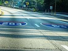
Interstate 283
| ||||
|---|---|---|---|---|
|
I-283 highlighted in red | ||||
| Route information | ||||
| Auxiliary route of I-83 | ||||
| Maintained by PennDOT | ||||
| Length | 2.907 mi[1] (4.678 km) | |||
| Existed | 1972 – present | |||
| Major junctions | ||||
| South end |
| |||
|
| ||||
| North end |
| |||
| Location | ||||
| Counties | Dauphin | |||
| Highway system | ||||
| ||||

Interstate 283 (I-283) is an auxiliary route of the Interstate Highway System located just east of Harrisburg, Pennsylvania, United States. It travels from the Harrisburg East interchange of I-76 (Pennsylvania Turnpike) north to I-83/US 322 (Capital Beltway) at the Eisenhower Interchange. Pennsylvania Route 283 (officially designated as SR 300 because of I-283) continues southeast from near the southern terminus of I-283 to Lancaster as a freeway, functioning as an extension of the interstate, though they are two separate roads.
Route description
I-283 begins at the Harrisburg East interchange of I-76 (Pennsylvania Turnpike) in Lower Swatara Township, Dauphin County. Past the interchange tollbooth, the road continues north and immediately reaches a cloverleaf interchange with the PA 283 freeway that also has access to PA 230 via Eisenhower Boulevard. I-283 continues north-northwest as a four-lane freeway, running past business parks before entering areas of farms and woods, crossing into Swatara Township. The road enters commercial areas as it comes to a diamond interchange with PA 441. After that exit, the road continues northwest before turning north and passing an industrial park. I-283 comes to an end at the Eisenhower Interchange with I-83/US 322 (Capital Beltway), at which point the freeway continues north as part of I-83/US 322.[2][3]
History
Construction began on the interstate in 1968.[4] Previously, the Harrisburg East interchange of the Pennsylvania Turnpike connected directly to Eisenhower Boulevard. The section from the Turnpike to PA 441 opened in 1970 and included a short portion of what is now PA 283, connecting Eisenhower Boulevard to the Exit 1 cloverleaf. The next year, the Eisenhower Interchange opened to traffic along with the remaining section of interstate.
As part of a project to reconstruct 6 miles (9.7 km) of PA 283, the interchange between I-283 and PA 283 is being improved.[5] The ramp from westbound PA 283 and northbound I-283 is being widened to two lanes, and the loop ramp from westbound PA 283 to southbound I-283 toward the Pennsylvania Turnpike toll plaza will be removed and replaced with a left turn and a traffic signal. This will eliminate the problem of traffic weaving between the aforementioned loop ramp and the heavily-traveled loop ramp from southbound I-283 to eastbound PA 283. The project is projected to be completed in late 2020.[5]
Exit list
The entire route is in Dauphin County.
| Location | mi[1] | km | Old exit [6] | New exit [6] | Destinations | Notes | |
|---|---|---|---|---|---|---|---|
| Lower Swatara Township | 0.000 | 0.000 | – | – | Southern terminus | ||
| 0.016 | 0.026 | 2E | 1A | Last free exit southbound; Access to Eisenhower Blvd via Exit 1B | |||
| 2W | 1B | ||||||
| Swatara Township | 1.860 | 2.993 | 1 | 2 | |||
| 2.907 | 4.678 | – | 3A | Northern terminus; Eisenhower Interchange | |||
| – | 3B | ||||||
| – | 3C | ||||||
1.000 mi = 1.609 km; 1.000 km = 0.621 mi
| |||||||
See also


References
Route map:
- 1 2 Bureau of Maintenance and Operations (January 2015). Roadway Management System Straight Line Diagrams (Report) (2015 ed.). Pennsylvania Department of Transportation. Retrieved June 30, 2015.
- Dauphin County (PDF)
- ↑ Google (2010-12-04). "overview of Interstate 283" (Map). Google Maps. Google. Retrieved 2010-12-04.
- ↑ Dauphin County, Pennsylvania Highway Map (PDF) (Map). PennDOT. 2010. Retrieved 2010-11-30.
- ↑ Jeffrey J. Kitsko (March 14, 2010). "Pennsylvania Highways: Interstate 283". Pennsylvania Highways. Retrieved September 28, 2018.
- 1 2 Knapp, Tom (May 5, 2017). "Work begins on 6 miles of Route 283, part of $1B project to improve Capital Beltway". Lancaster Online. Retrieved September 28, 2018.
- 1 2 "Pennsylvania Exit Numbering" (PDF). Pennsylvania Department of Transportation. Retrieved October 2, 2007.