Indre (river)
| Indre | |
|---|---|
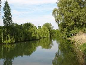 The Indre near Rigny-Ussé | |
| Native name | L'Indre (f) |
| Country | France |
| Physical characteristics | |
| Main source |
near Préveranges, Cher 504 m (1,654 ft) |
| River mouth |
Loire 47°14′2″N 0°11′0″E / 47.23389°N 0.18333°ECoordinates: 47°14′2″N 0°11′0″E / 47.23389°N 0.18333°E |
| Length | 279.3 km (173.5 mi) |
| Discharge |
|
| Basin features | |
| Progression | Loire→ Atlantic Ocean |
| Basin size | 3,462 km2 (1,337 sq mi) |
The Indre is a 279.3 km (173.5 mi) long river in central France, a left tributary to the Loire.[1]
Its source is in the department of Cher, near Préveranges. It flows through the departments of Cher, Indre and Indre-et-Loire. It flows generally northwest, through the communes of La Châtre, Châteauroux and Loches.
It joins the Loire near the site of the Chinon nuclear power plant, north of Avoine.
Its main tributary is the Indrois, which joins at Azay-sur-Indre.
Departments and towns along the river:
References
| Wikimedia Commons has media related to Indre River. |
This article is issued from
Wikipedia.
The text is licensed under Creative Commons - Attribution - Sharealike.
Additional terms may apply for the media files.