Ilz
| Ilz | |
|---|---|
 Ilz near Passau | |
| Country | Germany |
| Physical characteristics | |
| Main source |
Bavarian Forest ±430 m (1,410 ft) |
| River mouth |
Danube 48°34′31″N 13°28′32″E / 48.57528°N 13.47556°ECoordinates: 48°34′31″N 13°28′32″E / 48.57528°N 13.47556°E |
| Length | 40.3 km (25.0 mi) [1] |
| Basin features | |
| Progression | Danube→ Black Sea |
| Basin size | 850 km2 (330 sq mi) [1] |
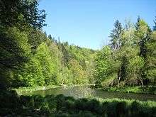
The Ilz (German pronunciation: [ˈɪlt͡s]) is a river running through the Bavarian Forest, Germany. It is a left tributary of the Danube and 40 km in length (69 km including its main source river Große Ohe), during which it travels down a height difference of ~140m.
The Ilz is formed at the confluence of its source rivers Große Ohe and Kleine Ohe in Eberhardsreuth. In the city of Passau it finally enters the Danube. Another town on the Ilz is Fürsteneck.
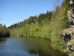
Ilz-Loop between Passau and Oberilzmühle
References
- 1 2 Complete table of the Bavarian Waterbody Register by the Bavarian State Office for the Environment (xls, 10.3 MB)
External links
- Ilz river (in German)
| Wikimedia Commons has media related to Ilz. |
This article is issued from
Wikipedia.
The text is licensed under Creative Commons - Attribution - Sharealike.
Additional terms may apply for the media files.