Ibie
| Ibie | |
|---|---|
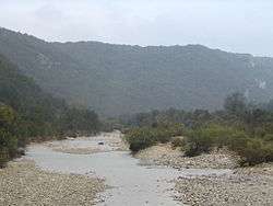 The Ibie. | |
| Country | France |
| Physical characteristics | |
| Main source |
Saint-Jean-le-Centenier 400 m (1,300 ft) 44°34′13″N 04°32′34″E / 44.57028°N 4.54278°E |
| River mouth |
Ardèche 78 m (256 ft) 44°23′36″N 04°23′59″E / 44.39333°N 4.39972°ECoordinates: 44°23′36″N 04°23′59″E / 44.39333°N 4.39972°E |
| Length | 32.9 km (20.4 mi) |
| Basin features | |
| Progression | Ardèche→ Rhône→ Mediterranean Sea |
The Ibie is a 32.9 km (20.4 mi) long river in the Ardèche département, southeastern France. Its source is at Saint-Jean-le-Centenier, 2 km (1.2 mi) south of the village. It flows generally south-southwest, through the northern part of the Côtes du Vivarais AOC. It is a left tributary of the Ardèche into which it flows at Vallon-Pont-d'Arc, 1.8 km (1.1 mi) southeast of the village.
Communes along its course
This list is ordered from source to mouth:
References
| Wikimedia Commons has media related to Ibie. |
This article is issued from
Wikipedia.
The text is licensed under Creative Commons - Attribution - Sharealike.
Additional terms may apply for the media files.