Howden Edge
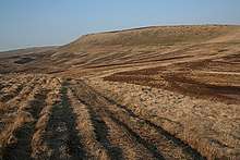
Howden Edge from Nether Hey
Howden Edge (grid reference SK187943) is a peak in the north-east of the Upper Derwent Valley area of the Peak District National Park in England. At 545 m (1,788 ft), it is the second-highest point in South Yorkshire, after Margery Hill. It is north-east of Howden Reservoir and north of Abbey Brook.
Coordinates: 53°26′43″N 1°43′12″W / 53.44514°N 1.71993°W
This article is issued from
Wikipedia.
The text is licensed under Creative Commons - Attribution - Sharealike.
Additional terms may apply for the media files.