Mount Homa
| Mount Homa | |
|---|---|
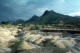 Mount Homa in 1994 | |
| Highest point | |
| Elevation | 1,751 m (5,745 ft) |
| Coordinates | 0°23′S 34°30′E / 0.38°S 34.50°ECoordinates: 0°23′S 34°30′E / 0.38°S 34.50°E |
| Geography | |
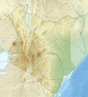 Mount Homa Location in Kenya | |
| Location | Kenya |
| Geology | |
| Mountain type | Complex volcano |
| Last eruption | Unknown |
Mount Homa is a mountain located in western Kenya. It forms a broad peninsula on the southern shore of Winam Gulf, an extension of Lake Victoria. This peninsula defines Homa Bay and the mountaintop is about 20 kilometres north of the town of that name.
In the Luo language Got Uma or God Marahuma means "famous mountain".
The mountain is formed of carbonatite lava and dates from Miocene to Pleistocene. Along with the active Ol Doinyo Lengai, it is one of the very few carbonatite volcanoes in the world.
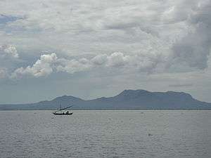
Mount Homa, on Lake Victoria, Kenya. View from across Winam Gulf, looking south.
See also
References
This article is issued from
Wikipedia.
The text is licensed under Creative Commons - Attribution - Sharealike.
Additional terms may apply for the media files.