Hochseiler
| Hochseiler | |
|---|---|
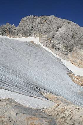 The Hochseiler from the east. In front, the westernmost part of the Übergossene Alm | |
| Highest point | |
| Elevation | 2,793 m (AA) (9,163 ft) |
| Prominence | 90 m ↓ Teufelslöcher |
| Isolation | 1.3 km → Lamkopf |
| Coordinates | 47°25′51″N 13°01′50″E / 47.430774°N 13.030557°ECoordinates: 47°25′51″N 13°01′50″E / 47.430774°N 13.030557°E |
| Geography | |
 Hochseiler | |
| Parent range | Hochkönig massif, Berchtesgaden Alps |
The Hochseiler (also Hochsailer) is a mountain, 2,793 m (AA), in the Hochkönig massif within the Berchtesgaden Alps. It lies on the boundary between the districts of Zell am See and St. Johann im Pongau in the Austrian state of Salzburg.
The summit can be gained from the north along the Mooshammersteig path or from the Teufelslöcher over the Übergossene Alm along the southeastern arête (climbing grade I–II).
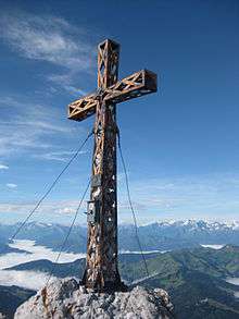
Summit cross
Literature
- Bernhard Kühnhauser (2011). Alpine Club Guide Berchtesgadener Alpen mit Hochkönig (in German) (20th ed.). Munich: Bergverlag Rother. pp. 425, 574. ISBN 978-3-7633-1127-9.
- Albert Precht: Alpenvereinsführer Hochkönig. 1st edn., Bergverlag Rother, Munich, 1989, ISBN 978-3-7633-1259-7.
| Wikimedia Commons has media related to Hochseiler. |
This article is issued from
Wikipedia.
The text is licensed under Creative Commons - Attribution - Sharealike.
Additional terms may apply for the media files.