Hen Gaer
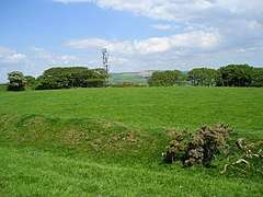 Looking north-east across Hen Gaer | |
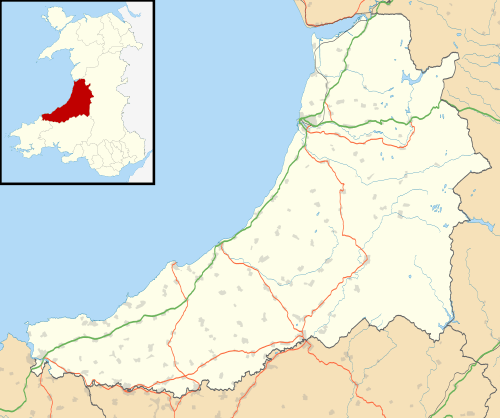 Shown within Ceredigion | |
| Location |
Near Bow Street, Ceredigion, Wales grid reference SN 633 844 |
|---|---|
| Coordinates | 52°26′25″N 4°00′46″W / 52.4403°N 4.0127°WCoordinates: 52°26′25″N 4°00′46″W / 52.4403°N 4.0127°W |
| Type | Hillfort |
| History | |
| Periods | Iron Age |
Hen Gaer is an Iron Age hillfort, on a hill adjacent to and east of Bow Street, Ceredigion, Wales.
Other names of the hillfort are Broncastellan and Caer Shon.[1]
Description
Hen Gaer ("Old Castle") is smaller than a typical tribal fortification. It is strongly defended; the single rampart is about 12 metres (39 ft) wide and 3–4 metres (10–13 ft) above the interior, with a rock-cut external ditch. On the north-east side, carefully laid stone blocks of the original rampart wall can be seen. The main entrance is on the west side. There is a circular mound outside the entrance: it is not an earlier barrow, but may be a defensive feature.[1][2]
The enclosed area includes some of the southern hillslope; it is thought this may have been to make the fortification visible from the narrow valley below, at the confluence of Afon Stewi and Nant Seilo forming Afon Clarach.[1]