Hemus Peak
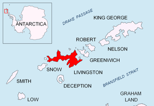


Hemus Peak (Vrah Hemus \'vr&h 'he-mus\) is an ice-covered peak rising to 636 m off the northwest extremity of Bowles Ridge in eastern Livingston Island. The feature is breast-shaped, 850 m long in east-west direction and 550 m wide, and overlooks Kaliakra Glacier to the northeast and Perunika Glacier to the southwest. Hemus is an ancient name of Stara Planina (Balkan Mountains), the central mountain range separating northern from southern Bulgaria.
Location
The peak is located at 62°36′22″S 60°13′14″W / 62.60611°S 60.22056°WCoordinates: 62°36′22″S 60°13′14″W / 62.60611°S 60.22056°W, which is 1.51 km northwest of Mount Bowles (822 m, summit of Bowles Ridge), 800 m north-northwest of Rayna Knyaginya Peak, 1.01 km north-northeast of Chirpan Peak, 3.6 km northeast of Rezen Knoll, 6.27 km east by north of Aleko Point, and 3.6 km south by east of the summit of Gleaner Heights (531 m) (Rough British mapping in 1968, Bulgarian mapping from a 1995-96 ground survey).
Maps
- South Shetland Islands. Scale 1:200000 topographic map. DOS 610 Sheet W 62 60. Tolworth, UK, 1968.
- Islas Livingston y Decepción. Mapa topográfico a escala 1:100000. Madrid: Servicio Geográfico del Ejército, 1991.
- L.L. Ivanov. Livingston Island: Central-Eastern Region. Scale 1:25000 topographic map. Sofia: Antarctic Place-names Commission of Bulgaria, 1996.
- S. Soccol, D. Gildea and J. Bath. Livingston Island, Antarctica. Scale 1:100000 satellite map. The Omega Foundation, USA, 2004.
- L.L. Ivanov et al., Antarctica: Livingston Island and Greenwich Island, South Shetland Islands (from English Strait to Morton Strait, with illustrations and ice-cover distribution), 1:100000 scale topographic map, Antarctic Place-names Commission of Bulgaria, Sofia, 2005
- L.L. Ivanov. Antarctica: Livingston Island and Greenwich, Robert, Snow and Smith Islands. Scale 1:120000 topographic map. Troyan: Manfred Wörner Foundation, 2010. ISBN 978-954-92032-9-5 (First edition 2009. ISBN 978-954-92032-6-4)
- Antarctic Digital Database (ADD). Scale 1:250000 topographic map of Antarctica. Scientific Committee on Antarctic Research (SCAR), 1993–2016.
External links
- Hemus Peak. SCAR Composite Antarctic Gazetteer
- Bulgarian Antarctic Gazetteer. Antarctic Place-names Commission. (details in Bulgarian, basic data in English)
This article includes information from the Antarctic Place-names Commission of Bulgaria which is used with permission.