Hawstead
| Hawstead, Suffolk | |
|---|---|
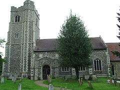 All Saints Church, Hawstead | |
 Hawstead, Suffolk Hawstead, Suffolk shown within Suffolk | |
| Population | 134 (2011 Census)[1] |
| Shire county | |
| Region | |
| Country | England |
| Sovereign state | United Kingdom |
| Post town | Bury St Edmunds |
| Postcode district | IP29 |
| EU Parliament | East of England |
Hawstead is a small village in Suffolk, England. It is located 5 kilometres (3 mi) south of Bury St. Edmunds between the B1066 and A134 roads, in a fork formed by the River Lark and a small tributary.
Hawstead Place, previously the seat of the Drury family, is now a farmhouse. Sir William Drury was sheriff and knight of the shire for Suffolk (UK Parliament constituency) Suffolk.
Hawstead, was also the name given by Lt Col Edward Robert Drury son of Rev Sir William Drury, when he ordered the Building of his beautiful Queenslander home in 1875. Lt. Col Edward Drury was the first General Manager and President of the Queensland Bank of Australia which today is known as the NAB, National Australia Bank. The building of his home was completed in 1876, perched in all its glory, on acreage on the edge of the Brisbane River in New Farm, the home was built to grand proportions of the day and written about in the Queenslander. See articles from www.trove.nla.gov.au and photographs attached on Facebook at Hawstead Brisbane Historical Home. In 2002 the home was cut and removed from its original dwelling place in New Farm, and transported to its current location at Thornlands, where it was restumped and rejoined. It cannot become a listed dwelling as it was removed from its original building place. The home was "dumped" according to neighbours, until restumped, re roofed, rejoined. The home remains a testament to the legacy of the Late Colonel Edward Robert Drury and his family and to the history of Queensland and to Brisbane's historical homes, lovingly cared for by its present owners.
Demography
According to the Office for National Statistics, at the time of the United Kingdom Census 2001, Hawstead had a population of 334 with 121 households.[2] falling to a population of 134 in 56 households at the 2011 Census.
Population change
| Population growth in Hawstead from 1801 to 1891 | ||||||||||
|---|---|---|---|---|---|---|---|---|---|---|
| Year | 1801 | 1811 | 1821 | 1831 | 1841 | 1851 | 1881 | 1891 | ||
| Population | 392 | 409 | 404 | 414 | 457 | 520 | 321 | 325 | ||
| Source: A Vision of Britain Through Time[3] | ||||||||||
| Population growth in Hawstead from 1901 to 2001 | |||||||||||
|---|---|---|---|---|---|---|---|---|---|---|---|
| Year | 1901 | 1911 | 1921 | 1931 | 1951 | 1961 | 2001 | 2011 | |||
| Population | 297 | 292 | 266 | 228 | 256 | 248 | 334 | 134 | |||
| Source: A Vision of Britain Through Time[3] | |||||||||||
Location grid
Neighbouring villages, and hamlets | |
|---|---|
References
- ↑ "Civil Parish population 2011". Neighbourhood Statistics. Office for National Statistics. Retrieved 22 August 2016.
- ↑ "Suffolk County Council - 2001 Census Profiles" (PDF). Archived from the original (PDF) on 2011-09-28. Retrieved 2011-02-22.
- 1 2 "A Vision of Britain Through Time". University of Portsmouth & others. Retrieved 2011-02-22.
External links
![]()