Hato Rey
| Hato Rey | |
|---|---|
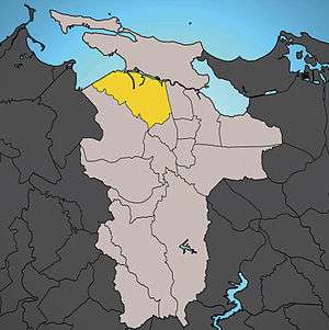
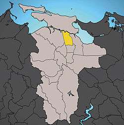
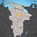
 Location of Hato Rey shown in yellow. | |
| Territory |
|
| Municipality | San Juan |
| Area | |
| • Total | 6.18 sq mi (16.01 km2) |
| • Land | 5.38 sq mi (13.93 km2) |
| • Water | 0.80 sq mi (2.07 km2) |
| Population (2000) | |
| • Total | 48,196 |
| • Density | 8,958.36/sq mi (3,458.84/km2) |
| 2000 census | |
Hato Rey is a former ward located in the northwest part of the dissolved municipality of Río Piedras. It now stretches over three wards of the municipality of San Juan, Puerto Rico:
 Hato Rey Sur
Urban landscape
Its name means "the king's cattle farm (hato)". In the 18th century, cattle would roam among the sugar cane fields in the area.[1] Its proximity to residential areas in San Juan, Río Piedras, Miramar, etc. made it a perfect location from where to produce what its residents would eat. The area also used to be known as "Las Monjas" (the nuns) due to a convent that used to be located in the area in the 19th century.
The Northern portion of Hato Rey is a startling contrast between the ward of the very poor and La Milla de Oro (The Golden Mile), a stretch that effectively covers only one mile but that is home to the headquarters of many large local and international banks that are one of the most important centers of Puerto Rico and the Caribbean's economy and some upper middle class condominiums.
Hato Rey is also home to a series of boutiques and restaurants (mostly along Roosevelt avenue). The José Miguel Agrelot Coliseum and the Tren Urbano (Urban Train) are reshaping Hato Rey and bringing people into the area after hours. The train is also helping to ease traffic woes in the area by decongesting the roads. Phi Sigma Alpha Fraternity's main headquarters are located in Mexico Street, Chile corner of Hato Rey.[2] The Hato Rey Lions Club, founded in 1955, is located in Alhambra Street, across from the Polytechnic University.
Because of its location, many commuters travelling to Old San Juan must drive through Hato Rey.


.jpg)
Economy

Important buildings in Hato Rey include the Banco Popular headquarters, Plaza Las Américas, and the Roberto Clemente Coliseum. Puerto Rico's FBI headquarters are also located in Hato Rey. Because of the area's closeness to the airport, major airlines, such as Avianca, have offices in Hato Rey.
Compaq at one point operated its Puerto Rico offices in Hato Rey.[3]
Government and infrastructure
The Federal Office Building, including the Federal Bureau of Investigation (FBI) San Juan field office, is in Hato Rey.[4]
The Puerto Rico Department of Education is headquartered in Hato Rey.[5]
See also
References
- ↑ "PUERTO RICO HERALD: Eatin' Where The Cows Used To Roam: Hato Rey Dining At Its Best". www.puertorico-herald.org.
- ↑ Shokooh Valle, Firuzeh (2005-03-14). "Fraternidad con fin social y sin violencia" (in Spanish). PRIMERA HORA. Retrieved 2008-01-03.
- ↑ "Compaq Offices Worldwide". archive.org. 25 December 1996.
- ↑ "San Juan Division." Federal Bureau of Investigation. Retrieved on June 9, 2015. "Federal Office Bldg., Suite 526 150 Carlos Chardon Avenue Hato Rey, PR 00918"
- ↑ Home page. Department of Education of Puerto Rico. Retrieved on May 6, 2017. "Dirección Física: Ave. Tnte. César González, esq. Calle Juan Calaf, Urb. Industrial Tres Monjitas, Hato Rey, P.R. 00917"