Hát Dịch
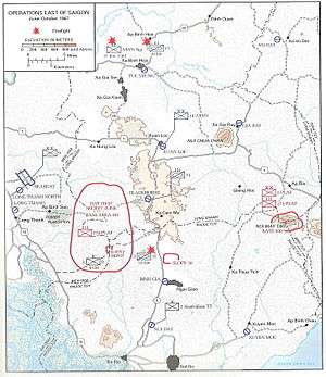
Map showing location of Hat Dich during the Vietnam War
Hát Dịch secret zone (mật khu Hát Dịch, chiến khu Hát Dịch) was an area within South Vietnam. It covered the area where the borders of Phước Tuy, Long Khánh and Biên Hòa Provinces met.
During the Vietnam War, the area was the headquarters for the Viet Cong (VC) 274th Regiment and was known as the Hat Dich secret zone and Base Area 301.[1] From Hát Dịch, the VC could harass Highway 1, the main supply route between Biên Hòa and Xuân Lộc District and all points further north. They could also interdict Highway 15 to Vũng Tàu, Highway 2 into Phước Tuy Province and Highway 20 to Da Lat.[2]
See also
References
- ↑ Lịch sử truyền thống 30 năm giao bưu vận nam bộ, 1945-1975 - Page 169 Công Đặng Bùi, Tỏ̂ng công ty bưu chính viẽ̂n thông Việt Nam - 2003 "Phái làm kho câ"t giâ"u và chuân bị vận chuyển hàng lên sông Thị Vái giao cho các đơn vị chuyến tiếp về chiến khu Hát Dịch. Cuối tháng 10/1963, đơn vị 340B được thành lập tương đương cáp tiếu đoàn do đông chỉ Bính làm Chỉ huy trưởng."
- ↑ MacGarrigle, George (1998). Combat Operations: Taking the Offensive, October 1966 to October 1967. Government Printing Office. pp. 379–80. ISBN 9780160495403.
Coordinates: 10°39′0″N 107°09′00″E / 10.65000°N 107.15000°E
This article is issued from
Wikipedia.
The text is licensed under Creative Commons - Attribution - Sharealike.
Additional terms may apply for the media files.