Hakkâri
| Hakkâri ܐܲܟܵܪܹ̈ܐ Akkārē | |
|---|---|
| Municipality | |
 Hakkâri | |
| Coordinates: 37°34′35″N 43°44′12″E / 37.57639°N 43.73667°ECoordinates: 37°34′35″N 43°44′12″E / 37.57639°N 43.73667°E | |
| Country | Turkey |
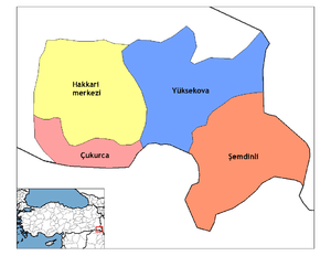
| Province | Hakkâri |
| Government | |
| • Mayor | Dilek Hatipoğlu (BDP) |
| Area[1] | |
| • District | 2,237.19 km2 (863.78 sq mi) |
| Elevation | 1,720 m (5,640 ft) |
| Population (2012)[2] | |
| • Urban | 58,584 |
| • District | 81,549 |
| • District density | 36/km2 (94/sq mi) |
Hakkâri (Syriac: ܗܲܟܵܐܪܝ̣ Hakkārī, Kurdish: Colemêrg), is a city and the capital of the Hakkâri Province of Turkey. It is located a few kilometres away from the Iraq-Turkey border. The name Hakkâri is derived from the Syriac word ܐܲܟܵܪܹ̈ܐ (Akkārē) meaning farmers or cultivators. Akkārē itself is derived from Akkadian ikkaru[3] The population of the city at the 2010 census was 57,844.[1]
History
Hubushkia
Hubushkia was an Iron Age kingdom located between the Urartian and Assyrian sphere of influence. The exact location of Hubushkia is unknown, but scholars suggests that the kingdom of Hubushkia was centred on the headwaters of the Great Zap River, in what is now Hakkâri Province in Eastern Anatolia, Turkey.[4] In its long history, the region has come under the rule of the Kardukh, Gutian, Kassite, Hurrian, Mitanni, Urartian, Nayiri, Median and Persian civilizations.[5]
Hakkari kurgan stelae
Thirteen Kurgan stelae, never before seen in Anatolia or the Near East, were found in 1998 in their original location at the centre of Hakkari. The stelae were carved on upright flagstone-like slabs measuring between 0.7 m to 3.10 m in height. The stones contain only one cut surface, upon which human figures are chiseled. The theme of each stele reveals the foreview of an upper human body. The legs are not represented. Eleven of the stelae depict naked warriors with daggers, spears, and axes—masculine symbols of war. They always hold a drinking vessel made of skin in both hands. Two stelae contain female figures without arms. The stelae may have been carved by different craftsmen using different techniques. Stylistic differences shift from bas relief to a more systematic linearity. The earliest stelae are in the style of bas relief while the latest ones are in a linear style. They were made during a period from the fifteenth century BC to the eleventh century BC in Hakkari. Stelae with this type of relief are not common in the ancient Near East however there are many close parallels between these and those produced by a variety of peoples from the Eurasian steppes between the third millennium BC and the eleventh century AD.[6]
Genocide
About 20,000 to 30,000 Assyrians in the area were killed by the Kurds and Turks,[7] during the Assyrian Genocide.[8] The majority of the Assyrian affected by the massacres were adherents of the Assyrian Church of the East (often dubbed incorrectly Nestorian), who have originally inhabited the mountainous Hakkari and Barwari regions covering parts of the modern provinces of the Hakkâri, Şırnak and Van in Turkey and Dohuk in Iraq, with a population ranging between 75,000 and 150,000.[9][10] Most of these Assyrians were massacred during the Genocide of 1915. The rest endured two winter marches to Urmia in 1915 and to Hamadan in 1918. Many of them were relocated to refugee camps by the British in Baquba and later to Habbaniyah, and in 1921 some were enlisted in the pro-British Assyrian Levies which helped quell Kurdish revolts in the British Mandate of Mesopotamia.[11] Most Hakkari Assyrians were resettled after 1925 in a cluster of villages in northern Iraq.[12] Some of the villages where the Assyrians settled were leased directly by the government, while others belonged to Kurdish landlords who had the right to evict them at any time.[13]
Climate
Hâkkari has a hot dry-summer continental climate (Köppen climate classification: Dsa) with a very dry and hot summer. The winters are cold and snowy with an average of −5 °C (23 °F). The lowest recorded temperature was −22.7 °C (−8.86 °F) on 7 February 1997. The summer are hot and dry with an average of 25 °C (76 °F). The highest recorded temperature was 37 °C (98.6 °F) on 2 August 1991.
| Climate data for Hâkkari (1960–2017) | |||||||||||||
|---|---|---|---|---|---|---|---|---|---|---|---|---|---|
| Month | Jan | Feb | Mar | Apr | May | Jun | Jul | Aug | Sep | Oct | Nov | Dec | Year |
| Record high °C (°F) | 11.8 (53.2) |
12.7 (54.9) |
19.7 (67.5) |
25.0 (77) |
28.7 (83.7) |
34.4 (93.9) |
38.8 (101.8) |
38.0 (100.4) |
34.6 (94.3) |
29.3 (84.7) |
20.8 (69.4) |
17.8 (64) |
38.8 (101.8) |
| Average high °C (°F) | −0.4 (31.3) |
1.1 (34) |
6.5 (43.7) |
12.9 (55.2) |
19.3 (66.7) |
25.8 (78.4) |
30.8 (87.4) |
30.9 (87.6) |
26.4 (79.5) |
18.5 (65.3) |
9.9 (49.8) |
2.5 (36.5) |
15.4 (59.7) |
| Daily mean °C (°F) | −4.6 (23.7) |
−3.2 (26.2) |
2.1 (35.8) |
8.2 (46.8) |
14.3 (57.7) |
20.3 (68.5) |
24.9 (76.8) |
24.8 (76.6) |
20.2 (68.4) |
13.0 (55.4) |
5.3 (41.5) |
−1.5 (29.3) |
10.3 (50.5) |
| Average low °C (°F) | −8.0 (17.6) |
−6.8 (19.8) |
−1.8 (28.8) |
3.9 (39) |
9.1 (48.4) |
14.0 (57.2) |
18.2 (64.8) |
18.1 (64.6) |
13.8 (56.8) |
7.8 (46) |
1.1 (34) |
−4.8 (23.4) |
5.4 (41.7) |
| Record low °C (°F) | −23.4 (−10.1) |
−22.7 (−8.9) |
−19.0 (−2.2) |
−8.3 (17.1) |
−0.8 (30.6) |
5.0 (41) |
10.0 (50) |
2.1 (35.8) |
4.3 (39.7) |
−5.8 (21.6) |
−15.0 (5) |
−21.3 (−6.3) |
−23.4 (−10.1) |
| Average precipitation mm (inches) | 90.1 (3.547) |
105.1 (4.138) |
120.3 (4.736) |
126.9 (4.996) |
65.4 (2.575) |
15.8 (0.622) |
4.0 (0.157) |
2.8 (0.11) |
7.0 (0.276) |
61.4 (2.417) |
87.6 (3.449) |
93.1 (3.665) |
779.5 (30.689) |
| Average precipitation days | 11.1 | 10.8 | 13.1 | 13.4 | 11.9 | 4.1 | 1.4 | 1.0 | 1.9 | 8.4 | 8.5 | 9.9 | 95.5 |
| Mean monthly sunshine hours | 124.0 | 146.9 | 179.8 | 201.0 | 275.9 | 351.0 | 378.2 | 356.5 | 303.0 | 223.2 | 159.0 | 120.9 | 2,819.4 |
| Mean daily sunshine hours | 4.0 | 5.2 | 5.8 | 6.7 | 8.9 | 11.7 | 12.2 | 11.5 | 10.1 | 7.2 | 5.3 | 3.9 | 7.7 |
| Source: Turkish State Meteorological Service[14] | |||||||||||||
Sport
The women's football club Hakkarigücü Spor was promoted to the Women's First League to take part in the 2018–19 season after finishing the 2017–18 Second League season as runners-up.[15]
See also
References
- 1 2 "Area of regions (including lakes), km²". Regional Statistics Database. Turkish Statistical Institute. 2002. Retrieved 2013-03-05.
- ↑ "Population of province/district centers and towns/villages by districts - 2012". Address Based Population Registration System (ABPRS) Database. Turkish Statistical Institute. Retrieved 2013-02-27.
- ↑ . (2016-10-20). Retrieved on 2016-10-20.
- ↑ Veli Sevin, Mystery Stelae, Archaeology, Volume 53 Number 4, (July/August 2000).
- ↑ http://www.hurriyetdailynews.com/default.aspx?pageid=438&n=3000-years-later-kings-of-hakkari-see-the-light-of-day-1998-10-13
- ↑ Mystery Stelae. Archaeology.org. Retrieved on 2011-02-11.
- ↑ The Christian minorities in Turkey, 2006, p. 98.
- ↑ Ishaya, Arian. "Ph.D". JAAS.
- ↑ Joseph 2000, p. 60
- ↑ Gaunt & Bet-Sawoce 2006, pp. 125–126
- ↑ Stafford 2006, pp. 62–63
- ↑ Stafford 2006, pp. 42–43
- ↑ Stafford 2006, pp. 53–54
- ↑ "Resmi İstatistikler: İllerimize Ait Genel İstatistik Verileri" (in Turkish). Turkish State Meteorological Service. Archived from the original on 22 April 2018. Retrieved 22 April 2018.
- ↑ "Hakkarigücü Spor Kadın Futbol takımı sena hazırlanıyor". Habertürk (in Turkish). 20 August 2018. Retrieved 1 September 2018.
External links
| Wikivoyage has a travel guide for Hakkari. |