Hünersedel
| Hünersedel | |
|---|---|
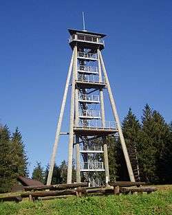 Viewing tower on the top of the Hünersedel | |
| Highest point | |
| Elevation | 744 m (2,441 ft) |
| Coordinates | 48°12′17″N 7°58′17″E / 48.20472°N 7.97139°ECoordinates: 48°12′17″N 7°58′17″E / 48.20472°N 7.97139°E |
| Geography | |
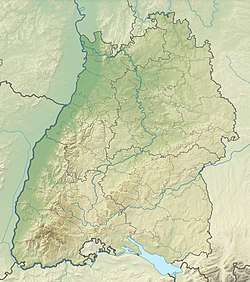 Hünersedel The location within Baden-Württemberg | |
| Location | Baden-Württemberg, Germany |
| Parent range | Black Forest |
The Hünersedel is a mountain located in the middle of the Black Forest, Germany, near the Schuttertal and the town of Freiamt. The mountain is 744 metres high and the source of the river Schutter.
The viewing tower on its top is 29 metres high and was erected in 2004.
This article is issued from
Wikipedia.
The text is licensed under Creative Commons - Attribution - Sharealike.
Additional terms may apply for the media files.