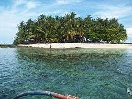
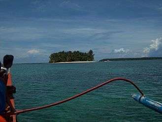
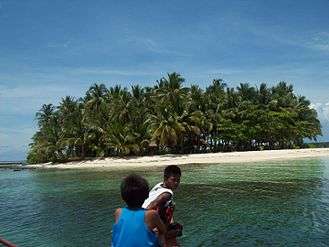
Guyam Island
 The island in 2012 | |
.svg.png) Guyam Island Location within the Philippines | |
| Geography | |
|---|---|
| Location | Philippine Sea |
| Coordinates | 9°45′54″N 126°10′4″E / 9.76500°N 126.16778°ECoordinates: 9°45′54″N 126°10′4″E / 9.76500°N 126.16778°E |
| Area | 4,300 m2 (46,000 sq ft) |
| Length | 64 m (210 ft) |
| Width | 84 m (276 ft) |
| Coastline | 230 m (750 ft) |
| Administration | |
| Region | Caraga |
| Province | Surigao del Norte |
| Municipality | General Luna |
Guyam Island is a tear-drop shaped island in the Philippine Sea situated 780 kilometres (480 mi) southeast of Manila in the province of Surigao del Norte. It is around 2 kilometres (1.2 mi) south-southeast of General Luna municipality. It is a popular stop for tourists doing island-hopping trips.
External links
This article is issued from
Wikipedia.
The text is licensed under Creative Commons - Attribution - Sharealike.
Additional terms may apply for the media files.