Gusinoozyorsk
| Gusinoozersk Гусиноозёрск (Russian) Галуута (Buryat) | |
|---|---|
| - Town[1] - | |
 Welcome sign at the entrance to Gusinoozersk | |
.svg.png) Gusinoozersk | |
| Administrative status (as of January 2013) | |
| Country | Russia |
| Federal subject | Republic of Buryatia[1] |
| Administrative district | Selenginsky District[1] |
| Town | Gusinoozersk[1] |
| Administrative center of | Selenginsky District,[1] Town of Gusinoozersk[1] |
| Municipal status (as of May 2013) | |
| Municipal district | Selenginsky Municipal District[2] |
| Urban settlement | Gusinoozersk Urban Settlement[2] |
| Administrative center of | Selenginsky Municipal District,[2] Gusinoozersk Urban Settlement[2] |
| Statistics | |
| Population (2010 Census) | 24,582 inhabitants[3] |
| Time zone | IRKT (UTC+08:00)[4] |
| Founded | 1939[5] |
| Town status since | 1953 |
| Previous names | Shakhty (until 1953) |
| Dialing code(s) | +7 30145 |
| Website |
admingus |
| Gusinoozersk on Wikimedia Commons | |
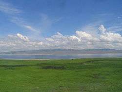
Gusinoozersk (Russian: Гусиноозёрск; Russian Buryat: Галуута, Galuuta) is a town and the administrative center of Selenginsky District of the Republic of Buryatia, Russia, located on the northeastern shore of Lake Gusinoye, 110 kilometers (68 mi) southwest of Ulan-Ude. Population: 24,582 (2010 Census);[3] 26,502 (2002 Census);[6] 29,790 (1989 Census);[7] 13,800 (1970).
History
It was founded in 1939 under the name Shakhty (Ша́хты),[5] in connection with the commencement of exploitation of brown coal deposits in the area. In 1953, it was granted town status and given its present name, derived from Gusinoye Ozero (lit. "goose lake"), the Russian name for the lake on which the town stands.
Administrative and municipal status
Within the framework of administrative divisions, Gusinoozersk serves as the administrative center of Selenginsky District.[1] As an administrative division, it is, together with two rural localities, incorporated within Selenginsky District as the Town of Gusinoozersk.[1] As a municipal division, the Town of Gusinoozyorsk is incorporated within Selenginsky Municipal District as Gusinoozersk Urban Settlement.[2]
Economy
The main focus of the town's economy remains brown coal production and the associated power station, although mining activities on the nearby deposits slowed during the economic crisis of the 1990s.
Transportation
Zagustay railway station on the Trans-Mongolian Railway is located 5 kilometers (3.1 mi) east of the town.
Military
The 245th Motor Rifle Division of the Russian Ground Forces was located in the town until it was reduced to a Base for Storage of Weapons and Equipment in 2006.
References
Notes
- 1 2 3 4 5 6 7 8 Resolution #43
- 1 2 3 4 5 Law #985-III
- 1 2 Russian Federal State Statistics Service (2011). "Всероссийская перепись населения 2010 года. Том 1" [2010 All-Russian Population Census, vol. 1]. Всероссийская перепись населения 2010 года (2010 All-Russia Population Census) (in Russian). Federal State Statistics Service. Retrieved June 29, 2012.
- ↑ Правительство Российской Федерации. Федеральный закон №107-ФЗ от 3 июня 2011 г. «Об исчислении времени», в ред. Федерального закона №271-ФЗ от 03 июля 2016 г. «О внесении изменений в Федеральный закон "Об исчислении времени"». Вступил в силу по истечении шестидесяти дней после дня официального опубликования (6 августа 2011 г.). Опубликован: "Российская газета", №120, 6 июня 2011 г. (Government of the Russian Federation. Federal Law #107-FZ of June 31, 2011 On Calculating Time, as amended by the Federal Law #271-FZ of July 03, 2016 On Amending Federal Law "On Calculating Time". Effective as of after sixty days following the day of the official publication.).
- 1 2 Энциклопедия Города России. Moscow: Большая Российская Энциклопедия. 2003. p. 114. ISBN 5-7107-7399-9.
- ↑ Russian Federal State Statistics Service (May 21, 2004). "Численность населения России, субъектов Российской Федерации в составе федеральных округов, районов, городских поселений, сельских населённых пунктов – районных центров и сельских населённых пунктов с населением 3 тысячи и более человек" [Population of Russia, Its Federal Districts, Federal Subjects, Districts, Urban Localities, Rural Localities—Administrative Centers, and Rural Localities with Population of Over 3,000] (XLS). Всероссийская перепись населения 2002 года [All-Russia Population Census of 2002] (in Russian). Retrieved August 9, 2014.
- ↑ Demoscope Weekly (1989). "Всесоюзная перепись населения 1989 г. Численность наличного населения союзных и автономных республик, автономных областей и округов, краёв, областей, районов, городских поселений и сёл-райцентров" [All Union Population Census of 1989: Present Population of Union and Autonomous Republics, Autonomous Oblasts and Okrugs, Krais, Oblasts, Districts, Urban Settlements, and Villages Serving as District Administrative Centers]. Всесоюзная перепись населения 1989 года [All-Union Population Census of 1989] (in Russian). Институт демографии Национального исследовательского университета: Высшая школа экономики [Institute of Demography at the National Research University: Higher School of Economics]. Retrieved August 9, 2014.
Sources
- Правительство Республики Бурятия. Постановление №431 от 18 ноября 2009 г. «О реестре административно-территориальных единиц и населённых пунктов Республики Бурятия», в ред. Постановления №573 от 13 ноября 2015 г. «О внесении изменений в Постановление Правительства Республики Бурятия от 18.11.2009 №431 "О реестре административно-территориальных единиц и населённых пунктов Республики Бурятия"». Вступил в силу 18 ноября 2009 г. Опубликован: "Бурятия", №216, Официальный вестник №120, 21 ноября 2009 г. (Government of the Republic of Buryatia. Resolution #431 of November 18, 2009 On the Registry of the Administrative-Territorial Units and the Inhabited Localities of the Republic of Buryatia, as amended by the Resolution #573 of November 13, 2015 On Amending Resolution #431 of November 18, 2009 of the Government of the Republic of Buryatia "On the Registry of the Administrative-Territorial Units and the Inhabited Localities of the Republic of Buryatia". Effective as of November 18, 2009.).
- Народный Хурал Республики Бурятия. Закон №985-III от 31 декабря 2004 г. «Об установлении границ, образовании и наделении статусом муниципальных образований в Республике Бурятия», в ред. Закона №1411-V от 14 октября 2015 г. «О внесении изменений в Закон Республики Бурятия "Об установлении границ, образовании и наделении статусом муниципальных образований в Республике Бурятия"». Вступил в силу со дня официального опубликования. Опубликован: "Бурятия", №1, Официальный вестник №1, 12 января 2005 г. (People's Khural of the Republic of Buryatia. Law #985-III of December 31, 2004 On Establishing the Borders, Creating, and Granting a Status to the Municipal Formations in the Republic of Buryatia, as amended by the Law #1411-V of October 14, 2015 On Amending the Law of the Republic of Buryatia "On Establishing the Borders, Creating, and Granting a Status to the Municipal Formations in the Republic of Buryatia". Effective as of the day of the official publication.).
Capital: Ulan-Ude • Rural localities | |||
| Districts | |||
| Cities and towns (all levels) | |||
| Urban-type settlements | |||