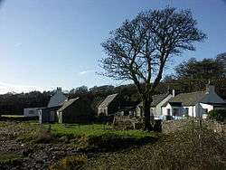
Grogport
| Grogport | |
|---|---|
 Grogport hamlet | |
| Coordinates: 55°38′26.6″N 5°29′1.19″W / 55.640722°N 5.4836639°W | |
| Country | Scotland |
| Elevation | 10 m (30 ft) |
| Coastal Village | |
Grogport is a hamlet in Argyll and Bute, Scotland, United Kingdom. It lies on the coast of Scotland, near Kilbrannan Sound, across from the Isle of Arran.
On one side of the coastal roadway that runs through Grogport there is a picnic spot on the beach, with views of Arran across the water. On the other side of the road lies the remnants of a Bronze Age Cist, a stone burial chamber. The Cist is known locally as "The Sailor's Grave" and is estimated to date to approximately 2000 BC.
Gallery
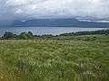 Coastal grassland south of Grogport.
References
- Royal Commission on the Ancient and Historical Monuments and Constructions of Scotland. 1971. Argyll: Kintyre, 233 pages
| Wikimedia Commons has media related to Grogport. |
This article is issued from
Wikipedia.
The text is licensed under Creative Commons - Attribution - Sharealike.
Additional terms may apply for the media files.