Große Laber
| Große Laber | |
|---|---|
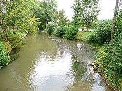 Große Laber at Sünching | |
| Country | Germany |
| Physical characteristics | |
| Main source | Lower Bavaria |
| River mouth |
Danube 48°53′49″N 12°33′37″E / 48.89694°N 12.56028°ECoordinates: 48°53′49″N 12°33′37″E / 48.89694°N 12.56028°E |
| Length | 87.5 km (54.4 mi) [1] |
| Basin features | |
| Progression | Danube→ Black Sea |
| Basin size | 875 km2 (338 sq mi) [1] |
The Große Laber (also: Große Laaber) is a river in Bavaria, Germany, right tributary of the Danube. Its source is near Volkenschwand. It is 87.5 km long. It flows northeast through the small towns Rottenburg an der Laaber, Schierling and Rain. It flows into the Danube near Straubing.
Tributaries
- Heisinger Bach (left)
- Koppenwaller Bach (left)
- Marktbach (right)
- Hornbacher Bach (left)
- Rennbach (left)
- Aumerer Bach (right)
- Ramersdorfer Graben (right)
- Lauterbach (left)
- Raschbach (left)
- Talbach (left)
- Rohrbach (left)
- Altbach (right)
- Helchenbachgraben (left)
- Sinsbuchgraben (left)
- Siegersbach (right)
- Starzenbach (left)
- Deggenbacher Bach (right)
- Oberbach (right)
- Einhauser Graben (left)
- Hochwiesenbach (right)
- Augraben (right)
- Hartlaber (right)
- Saubründlgraben (right)
- Kleine Laber (right)
References
- 1 2 Complete table of the Bavarian Waterbody Register by the Bavarian State Office for the Environment (xls, 10.3 MB)
External links
| Wikimedia Commons has media related to Große Laber. |
- Labertalprojekt - Wasserwirtschaftsamt Landshut
| Authority control |
|---|
This article is issued from
Wikipedia.
The text is licensed under Creative Commons - Attribution - Sharealike.
Additional terms may apply for the media files.