Greater Rio de Janeiro
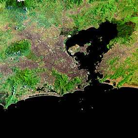
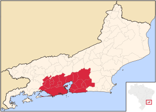
Greater Rio de Janeiro, officially Rio de Janeiro Metropolitan Region (Grande Rio, officially Região Metropolitana do Rio de Janeiro, in Portuguese) is a large metropolitan area located in Rio de Janeiro state in Brazil, the second largest in Brazil and third largest in South America. It consists of 21 municipalities, including the capital of the State, Rio de Janeiro.
The metropolitan area of Rio de Janeiro is known as a historical, cultural and economic centre of Brazil, with a total population of 12.6 million inhabitants. The region was first officially defined on July 1, 1974, less than 1 year till the fusion of Guanabara into Rio de Janeiro. Several municipalities show a high level of conurbation, with Rio de Janeiro–Baixada Fluminense and Niterói–São Gonçalo being the most clear examples. It was changed several times to include or remove different cities in different moments of the history, in the years 1993, 2001, 2002, 2009 and 2013.
The water supply plans of the region are coordinated, and transportation in the area is heavily interconnected with urban intermunicipal buses to all municipalities in the area, trains over the capital to some Baixada Fluminense municipalities, ferry boats to some of the Guanabara Bay municipalities and major inter-city freeways such as the Rio–Niterói Bridge, Red Line, President Dutra freeway and Niterói-Manilha freeway. Most transportation methods are integrated with the capital inner-transportation system of buses, trains, metro, freeways and expressways.
Cities by Population (2016)
+ 1,000,000
- Rio de Janeiro: 6,498,837
- São Gonçalo: 1,044,058
400,000 – 999,999
- Duque de Caxias: 886,917
- Nova Iguaçu: 797,435
- Niterói: 497,883
- Belford Roxo: 494,141
- São João de Meriti: 460,541
100,000 – 399,999
- Magé: 236,319
- Itaboraí: 230,786
- Mesquita: 171,020
- Nilópolis: 158,319
- Maricá: 149,876
- Queimados: 144,525
- Itaguaí: 120,855
- Japeri: 100,562
-100,000
- Seropédica: 83,667
- Rio Bonito: 57,963
- Guapimirim: 57,105
- Cachoeiras de Macacu: 56,603
- Paracambi: 50,071
- Tanguá: 32,703
Statistics
- Population: 12.330.186 (2016 est.)[1]
- Most populous city: Rio de Janeiro: 6,498,837 (2016 est.)
- Nominal GDP: R$404,37 Billion[2]
- Largest GDP City: Rio de Janeiro City: R$282,5 billion (2016 est.)
- Nominal GDP per capita: R$33,856.54 (2016 est.)
- HDI: 0,771 (2016 est.)
- Highest HDI City: Niterói: 0,837 (2016 est.)
Municipalities
The 21 municipalities of the area are:[3]
| Administrative division | Area (km²) | Population 2000 Census | Population (2010 Census)[4] | Population (2016 est.) | Population density 2010 (/km²) |
|---|---|---|---|---|---|
| Belford Roxo | 77.815 | 434,474 | 469,261 | 494,141 | 5,919.49 |
| Cachoeiras de Macacu | 953.801 | 48.543 | 54,273 | 56,603 | 5.90 |
| Duque de Caxias | 467.62 | 775,456 | 855,046 | 886,917 | 1.887.71 |
| Guapimirim | 360.766 | 37,952 | 51,487 | 57,105 | 156.65 |
| Itaboraí | 430.374 | 187,479 | 218,090 | 230,786 | 532.11 |
| Itaguaí | 274.433 | 82,003 | 109,091 | 120,855 | 523.38 |
| Japeri | 81.869 | 83,278 | 95,391 | 100,562 | 1,219.79 |
| Magé | 388.496 | 205,830 | 228,150 | 236,319 | 604.41 |
| Maricá | 362.571 | 76,737 | 127,61 | 149,876 | 404.19 |
| Mesquita | 41.477 | no data | 168,403 | 171,020 | 4,116.76 |
| Nilópolis | 19.393 | 153,712 | 157,483 | 158,319 | 8,163.20 |
| Niterói | 133.916 | 459,451 | 487,327 | 497,883 | 3,709.01 |
| Nova Iguaçu | 519.159 | 920,599 | 797,212 | 797,435 | 1,555.38 |
| Paracambi | 179.772 | 40,475 | 47,124 | 50,071 | 275.47 |
| Queimados | 75.695 | 121,993 | 137,938 | 144,525 | 1,573.99 |
| Rio Bonito | 465.455 | 49,691 | 55,551 | 57,963 | 123.78 |
| Rio de Janeiro | 1,199.828 | 5,857,904 | 6,323,037 | 6,498,837 | 5,397.97 |
| São Gonçalo | 247.709 | 891,119 | 1,013,901 | 1,044,058 | 4,190.73 |
| São João de Meriti | 35.216 | 449,476 | 459,356 | 460,541 | 13,662.17 |
| Seropédica | 283.766 | 65,260 | 78,183 | 83,667 | 292.11 |
| Tanguá | 145.503 | 26,057 | 30,731 | 32,703 | 222.85 |
| Metropolitan Rio Janeiro | 6,744.634 | 10,670,040 | 12,603,936 | 12,330,186 | 1,820.81 |
Notes and references
- ↑ http://www.ibge.gov.br/home/estatistica/populacao/estimativa2016/estimativa_tcu.shtm
- ↑ http://www.ceperj.rj.gov.br/ceep/pib/pib.html
- ↑ http://cidades.ibge.gov.br/xtras/uf.php?lang=&coduf=33&search=rio-de-janeiro
- ↑ http://www.ibge.gov.br/home/estatistica/populacao/censo2010/tabelas_pdf/total_populacao_rio_de_janeiro.pdf IBGE Census 2010