Grant Island
 Map of Grant Island | |
 Grant Island Location in Antarctica | |
| Geography | |
|---|---|
| Location | Antarctica |
| Coordinates | 74°28′S 131°35′W / 74.467°S 131.583°WCoordinates: 74°28′S 131°35′W / 74.467°S 131.583°W |
| Area | 703 km2 (271 sq mi) |
| Length | 37 km (23 mi) |
| Width | 19 km (11.8 mi) |
| Administration | |
| Administered under the Antarctic Treaty System | |
| Demographics | |
| Population | Uninhabited |
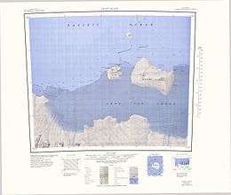
Grant Island is an ice-covered island, 32 kilometres (20 mi) long and 16 kilometres (10 mi) wide, lying 8 km (5 mi) east of the smaller Shepard Island off the coast of Marie Byrd Land, Antarctica. Like Shepard Island, Grant Island is surrounded by the Getz Ice Shelf on all but the north side. Grant Island was discovered and charted by personnel on the USS Glacier on February 4, 1962. Grant Island was named by the United States Advisory Committee on Antarctic Names (US-ACAN) for Commander E. G. Grant, Commanding Officer of the USS Glacier at the time of discovery.
See also
References
External links
![]()
This article is issued from
Wikipedia.
The text is licensed under Creative Commons - Attribution - Sharealike.
Additional terms may apply for the media files.