Guelmim
| Guelmim, Morocco Guelmim / ⴳⵯⴻⵍⵎⵉⵎ گلميم | |
|---|---|
    | |
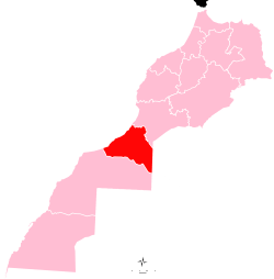
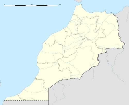 Guelmim, Morocco Location in Morocco | |
| Coordinates: 28°59′N 10°04′W / 28.983°N 10.067°W | |
| Country |
|
| Region | Guelmim-Oued Noun |
| Province | Guelmim |
| Population (2014)[1] | |
| • Total | 118,318 |
| Time zone | UTC+0 (WET) |
| • Summer (DST) | UTC+1 (WEST) |
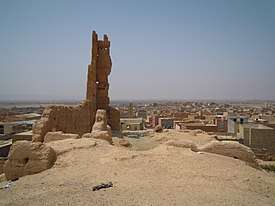
Guelmim (in Berber languages: Gʷelmim, ⴳⵯⴻⵍⵎⵉⵎ, in Arabic: گلميم, also spelled in European sources: Glaimim, Goulimine or Guelmin), is a city in southern Morocco, often called Gateway to the Desert. It is the capital of the Guelmim-Oued Noun region which includes southern Morocco (south of the Souss-Massa region) and the northeastern corner of Western Sahara. The population of the city was 187,808 as of the 2014 Moroccan census,[1] making it the largest city in the region. The N1 and N12 highways cross at Guelmim and link it to the nearby region of Souss-Massa.
Guelmim is located just north of Asrir, which was the site of an important trade-route city and the capital of the Saharan tribes. It was known in Arabic sources as Noul Lamta.
It is home to a camel market. When hippies "discovered" certain types of colorful African trade beads there in the 1960s, these became known as "Goulamine beads" though they were actually manufactured in Europe, primarily in Venice, Italy.
Many of the inhabitants speak the Hassaniya dialect, as it is part of the Sahrawi-inhabited southern region of Morocco.
Climate
| Climate data for Guelmim | |||||||||||||
|---|---|---|---|---|---|---|---|---|---|---|---|---|---|
| Month | Jan | Feb | Mar | Apr | May | Jun | Jul | Aug | Sep | Oct | Nov | Dec | Year |
| Average high °C (°F) | 18.9 (66) |
20.1 (68.2) |
21.7 (71.1) |
22.9 (73.2) |
24.4 (75.9) |
25.9 (78.6) |
27.6 (81.7) |
28.0 (82.4) |
26.9 (80.4) |
25.6 (78.1) |
22.5 (72.5) |
19.5 (67.1) |
23.7 (74.6) |
| Average low °C (°F) | 8.8 (47.8) |
9.4 (48.9) |
11.7 (53.1) |
13.2 (55.8) |
15.7 (60.3) |
17.3 (63.1) |
18.9 (66) |
19.2 (66.6) |
18.1 (64.6) |
15.9 (60.6) |
12.6 (54.7) |
9.6 (49.3) |
14.2 (57.6) |
| Average precipitation mm (inches) | 18 (0.71) |
16 (0.63) |
11 (0.43) |
9 (0.35) |
2 (0.08) |
1 (0.04) |
1 (0.04) |
1 (0.04) |
5 (0.2) |
10 (0.39) |
19 (0.75) |
26 (1.02) |
119 (4.69) |
| Source: Climate-data.org | |||||||||||||
See also
References
- 1 2 "POPULATION LÉGALE DES RÉGIONS, PROVINCES, PRÉFECTURES, MUNICIPALITÉS, ARRONDISSEMENTS ET COMMUNES DU ROYAUME D'APRÈS LES RÉSULTATS DU RGPH 2014" (in Arabic and French). High Commission for Planning, Morocco. 8 April 2015. Retrieved 29 September 2017.
External links
![]()