Goubetto
| Goubetto جوبيتو | |
|---|---|
| Town | |
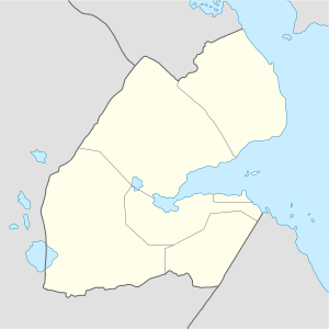 Goubetto جوبيتو Location in Djibouti | |
| Coordinates: 11°25′26″N 43°00′01″E / 11.42389°N 43.00028°ECoordinates: 11°25′26″N 43°00′01″E / 11.42389°N 43.00028°E | |
| Country |
|
| Region | Ali Sabieh |
| Elevation | 345 m (1,132 ft) |
| Population | |
| • Total | 1,400 |
Goubetto (Arabic: جوبيتو), also spelled Goubétto, is a town in Djibouti. Located in the Ali Sabieh region, it is served by a station on the Ethio-Djibouti Railways. The eastern part of the same plateau is crossed by numerous valleys and dry watercourses. Goat and camel raising form the basis of the economy.
Demographics
As of 2015, the population of Goubetto has been estimated to be 1,400. The city inhabitants belong to various mainly Afro-Asiatic-speaking ethnic groups, with the Issa Somali predominant.
Climate
Goubetto has a hot desert climate (BWh) in Köppen-Geiger system.
| Climate data for Goubetto | |||||||||||||
|---|---|---|---|---|---|---|---|---|---|---|---|---|---|
| Month | Jan | Feb | Mar | Apr | May | Jun | Jul | Aug | Sep | Oct | Nov | Dec | Year |
| Average high °C (°F) | 27.0 (80.6) |
28.0 (82.4) |
29.8 (85.6) |
31.7 (89.1) |
34.9 (94.8) |
39.1 (102.4) |
38.8 (101.8) |
38.6 (101.5) |
35.8 (96.4) |
30.7 (87.3) |
28.3 (82.9) |
27.1 (80.8) |
32.5 (90.5) |
| Average low °C (°F) | 17.5 (63.5) |
18.5 (65.3) |
20.8 (69.4) |
23.2 (73.8) |
25.2 (77.4) |
28.9 (84) |
28.8 (83.8) |
27.7 (81.9) |
27.2 (81) |
23.5 (74.3) |
20.0 (68) |
18.3 (64.9) |
23.3 (73.9) |
| Average rainfall mm (inches) | 12 (0.47) |
20 (0.79) |
25 (0.98) |
30 (1.18) |
9 (0.35) |
4 (0.16) |
6 (0.24) |
21 (0.83) |
12 (0.47) |
13 (0.51) |
35 (1.38) |
12 (0.47) |
199 (7.83) |
| Source: Climate-Data.org | |||||||||||||
See also
References
External links
This article is issued from
Wikipedia.
The text is licensed under Creative Commons - Attribution - Sharealike.
Additional terms may apply for the media files.