Gomoa District
| Gomoa District | |
|---|---|
| Defunct District | |
 Location of Gomoa District in Central Region | |
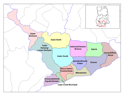
 Gomoa District Location of Gomoa District in Central Region | |
| Coordinates: 5°16′55″N 0°44′31″W / 5.282°N 0.742°WCoordinates: 5°16′55″N 0°44′31″W / 5.282°N 0.742°W | |
| Region | Central Region |
| Area | |
| • Total | 891 km2 (344 sq mi) |
| Population | |
| • Ethnicity | Akan people |
The Gomoa District is a former district that was located in the Central Region of Akanland, Ghana.
History
The Gomoa district was mainly inhabited by the Akan-subgroup Fantes. The inhabitants were mainly farmers and fishermen.
Apam was the capital of Gomoa district. The locals however called it Apaa instead of the Apam that others called it. Most of the people living in Apam were engaged in fishing, supplying the land-locked villages surrounding it with fish. There is also a vibrant salt industry in Apam, in which salt is got from the lagoon. There is a secondary school and a hospital that serves the people of Apam and the surrounding areas.
One of the main attractions in Apam is a fort built by the Portuguese, called Fort Patience.
The people of Apam celebrate the "Akwambo" festival. Akwambo basically means "the making of a way". It is celebrated to make the time when their ancestors made their way to Apam.
Sources
- "Gomoa District". Statoids.
- District: Gomoa
| Metropolitan |
| .svg.png) |
|---|---|---|
| Municipal |
| |
| District |
| |