Goheung County
| Goheung 고흥군 | ||
|---|---|---|
| County | ||
| Korean transcription(s) | ||
| • Hangul | 고흥군 | |
| • Hanja | 高興郡 | |
| • Revised Romanization | Goheung-gun | |
| • McCune-Reischauer | Kohŭng-gun | |
 Goheung County Office in Goheung, Jeollanam-do | ||
| ||
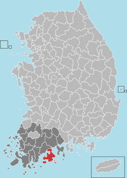 Location in South Korea | ||
| Country |
| |
| Region | Honam | |
| Administrative divisions | 2 eup, 14 myeon | |
| Area | ||
| • Total | 775.5 km2 (299.4 sq mi) | |
| Population (2015) | ||
| • Total | 70,000 | |
| • Density | 90/km2 (200/sq mi) | |
| • Dialect | Jeolla | |
Goheung County (Goheung-gun) is a county in Jeollanam-do Province, South Korea.
Naro Space Center
The Naro Space Center was completed during 2008 in southern Goheung 34°25′55″N 127°32′06″E / 34.431867°N 127.535069°E[1] and is operated by the state-run Korea Aerospace Research Institute. The space center includes a launch pad, a control tower, rocket assembly and test facilities, facilities for satellite control testing and assembly, a media center, an electric power station, a space experience hall (visitor center) and a landing field.[2][3]
Modern history
On New Year's Day in 1963, some of the townships were classed from Bongrae myun (Korean town) to other myuns such as Dohwa myun, Podu myun and so on. [4] In 1973 and 1979, two of the townships were promoted to eups(towns)
Symbols
- City Tree : Citron tree
- County flower : Camellia blossom
- County bird : Dove
Location
Goheung is located in one of the southernmost areas of the Korean peninsula. It is surrounded by ocean on three sides with 19 inhabited islands and 152 uninhabited islands. The depth is not that low and its land spreads along the coast so many shellfish and seaweed industries have developed.[5]
| Wikimedia Commons has media related to Goheung, Jeollanam-do. |
Climate
| Climate data for Goheung (1981–2010) | |||||||||||||
|---|---|---|---|---|---|---|---|---|---|---|---|---|---|
| Month | Jan | Feb | Mar | Apr | May | Jun | Jul | Aug | Sep | Oct | Nov | Dec | Year |
| Average high °C (°F) | 6.9 (44.4) |
9.0 (48.2) |
13.3 (55.9) |
19.1 (66.4) |
23.3 (73.9) |
26.1 (79) |
28.9 (84) |
30.3 (86.5) |
26.9 (80.4) |
22.3 (72.1) |
15.7 (60.3) |
9.8 (49.6) |
19.3 (66.7) |
| Daily mean °C (°F) | 1.3 (34.3) |
3.0 (37.4) |
7.2 (45) |
12.7 (54.9) |
17.3 (63.1) |
21.1 (70) |
24.7 (76.5) |
25.7 (78.3) |
21.6 (70.9) |
15.7 (60.3) |
9.2 (48.6) |
3.5 (38.3) |
13.6 (56.5) |
| Average low °C (°F) | −3.6 (25.5) |
−2.4 (27.7) |
1.3 (34.3) |
6.2 (43.2) |
11.4 (52.5) |
16.6 (61.9) |
21.4 (70.5) |
22.0 (71.6) |
16.9 (62.4) |
9.7 (49.5) |
3.2 (37.8) |
−2.0 (28.4) |
8.4 (47.1) |
| Average precipitation mm (inches) | 27.7 (1.091) |
48.9 (1.925) |
80.6 (3.173) |
120.1 (4.728) |
140.2 (5.52) |
216.0 (8.504) |
266.7 (10.5) |
268.7 (10.579) |
175.1 (6.894) |
43.6 (1.717) |
46.7 (1.839) |
19.3 (0.76) |
1,453.4 (57.22) |
| Average precipitation days (≥ 0.1 mm) | 5.3 | 6.0 | 8.3 | 8.4 | 9.1 | 9.9 | 13.0 | 11.7 | 8.7 | 4.5 | 6.0 | 4.3 | 95.2 |
| Average relative humidity (%) | 65.1 | 64.2 | 64.0 | 64.0 | 68.2 | 74.5 | 80.0 | 77.2 | 74.4 | 69.1 | 68.5 | 67.1 | 69.7 |
| Mean monthly sunshine hours | 173.0 | 176.9 | 205.4 | 226.2 | 233.0 | 192.6 | 180.6 | 212.2 | 191.8 | 221.2 | 179.7 | 176.9 | 2,370.3 |
| Source: Korea Meteorological Administration[6] | |||||||||||||
Twin towns – sister cities
Goheung is twinned with:
See also
External links
References
- ↑ "S. Korea Completes Work on Naro Space Center". 10 June 2009.
- ↑ Pike, John. "Naro Space Center". www.globalsecurity.org.
- ↑ "YONHAP NEWS". english.yonhapnews.co.kr.
- ↑ Alteration of the districts of boundaries including cities and counties(1962.11.21.)
- ↑ "Goheung county". eng.goheung.go.kr.
- ↑ "평년값자료(1981–2010) 고흥(262)". Korea Meteorological Administration. Retrieved 2011-05-06.
