Geology of China
The Geology of China (中国地质, Zhōngguó dì zhì) (or the geological structure of the People's Republic of China) can be divided into several parts. The historical centre of Chinese culture is on the loess plateau, the world's largest Quaternary loess deposit, and on the alluvial lands at the east of it. The alluvial East China plain extends from just south of Beijing in the north, to the Yangzi river delta in the south, punctuated only by the igneous Shandong highlands and peninsula. South of the Yangzi river, most of the landscape is mountainous, dominated by sedimentary deposits and by the Yangzi craton. The most famous scenery in China is found in the karst landscapes of Guangxi and Yunnan provinces. The alluvial Sichuan basin is surrounded by mountains, the Qinling mountains to the north and the Himalaya to the west and southwest. Much of Northeast China, or Manchuria, is dominated by alluvial plains, but the border regions with Korea are also highly mountainous. In the west, most of the Tibetan plateau is in China, and averages over 4000 metres in elevation. The Yunnan-Guizhou plateau is also an extension of the Tibetan plateau.[2]
Geoscience
It was not until late in the Qing Dynasty (1644–1911) that the government formulated a policy to introduce foreign science and technology into China. Modern geologic ideas were introduced with the establishment of technical schools and the translation into Chinese of works by James D. Dana and Charles Lyell during the 1870s. Early in the twentieth century, foreign geology teachers were brought to China and Chinese students were sent to foreign countries to study geology. This infusion successfully developed the modern teaching and practice of geology in China.[3]
China Geology Information Infrastructure
The China Geological Survey (CGS) constructed its geological survey information infrastructure to meet the needs of international cooperation and coordination, disseminate public geoscience knowledge and information, and to promote the sustainable development of the national economy and society.[4] The main line of the geological survey informationization is the informationization of whole procedure of the geological survey including project application, designing, implement, data processing and providing the geoscience information to the public; The construction of information standardization, basic network, technological development and project management system make up of its technological support; The construction of national basic geoscience database is the data support.
Geological Parks
China has 44 national geological parks managed since 1999 by the Chinese Ministry of Land and Resources in cooperation with UNESCO to find a way to protect geological sites of importance while encouraging both tourism and scientific research. Zhangjiajie Gritstone-peak Forest, China's best preserved cluster of volcanoes and geological features in Hunan Province, in 2001 became among the first nationally designated geological park. In February 2004, UNESCO announced the World Network of Geological Parks as well as its first geology park conference to be held in Beijing from June 27–29, 2004. Of the 28 original UNESCO World Geoparks, eight are in China. Currently there 26 World Geoparks in China,[5] including the following:
- Shilin Geopark in China's Yunnan Province, featuring a carbonate peak forest landform, which brings about the formation of various karst landscapes, such as stone teeth, corroded gullies and corroded funnels.
- Huangshan Geopark in Anhui Province, famed for its grand and steep mountains, with 72 peaks of over 1,000 meters high. The geopark is picturesque with green and straight pines, jagged rocks of grotesque shapes, wide and imposing cloud sea, as well as many gushing warm springs.
- Other world-class Chinese geology parks include Lushan Geopark in Jiangxi Province, Yuntaishan Geopark and Songshan Geopark in central China's Henan Province, Danxia Geopark in Guangdong, Zhangjiajie Geopark in Hunan, and Wudalianchi Geopark in northeast China's Heilongjiang Province.
See also
References
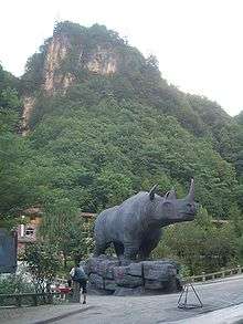
- ↑ Tong, Haowen; Wu, Xianzhu (2010), "Stephanorhinus kirchbergensis (Rhinocerotidae, Mammalia) from the Rhino Cave in Shennongjia, Hubei" (PDF), China Science Bulletin, 55 (12): 1157–1168
- ↑ doi:10.1306/3D9336BA-16B1-11D7-8645000102C1865D Outline of Chinese Geology J. Marvin Weller (2) AAPG Bulletin Volume 28 (1944)
- ↑ A History of Geology and Geological Education in China (to 1949) Archived 2012-07-12 at Archive.is
- ↑ http://www.gisdevelopment.net/application/geology/geomorphology/ma04239abs.htm
- ↑ Geopark Members http://www.unesco.org
External links
- China Geological Survey
- Geological Society of China
- Chinese Academy of Geological Sciences
- China Geo-environmental Information Network
- Chinese Geoscience Data Network
- World Data Center for Geology, Beijing
- Institute of Geology and Geophysics
- Institute of Geomechanics
- Institute of Geology, China Earthquake Administration
- China Metallurgical Geology Bureau
- China Geological Library
| Sovereign states |
|
|---|---|
| States with limited recognition |
|
| Dependencies and other territories |
|
| |