Caribbean
.svg.png)
The Caribbean (/ˌkærɪˈbiːən,
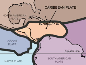
Situated largely on the Caribbean Plate, the region comprises more than 700 islands, islets, reefs and cays. (See the list of Caribbean islands.) These islands generally form island arcs that delineate the eastern and northern edges of the Caribbean Sea.[6] The Caribbean islands, consisting of the Greater Antilles on the north and the Lesser Antilles on the south and east (including the Leeward Antilles), are part of the somewhat larger West Indies grouping, which also includes the Lucayan Archipelago (comprising the Bahamas and Turks and Caicos Islands). The Lucayans and, less commonly, Bermuda, are also sometimes considered Caribbean despite the fact that none of these islands border the Caribbean Sea. In a wider sense, the mainland countries, regions, and territories of Belize, the Caribbean region of Colombia, Cozumel, the Yucatán Peninsula, Margarita Island, the Guyanas (Guyana, Suriname, French Guiana, Guayana Region in Venezuela, and Amapá in Brazil), are often included due to their political and cultural ties with the region.[7]
Geopolitically, the Caribbean islands are usually regarded as a subregion of North America[8][9][10][11][12] and are organized into 30 territories including sovereign states, overseas departments, and dependencies. From December 15, 1954, to October 10, 2010, there was a country known as the Netherlands Antilles composed of five states, all of which were Dutch dependencies.[13] From January 3, 1958, to May 31, 1962, there was also a short-lived political union called the West Indies Federation composed of ten English-speaking Caribbean territories, all of which were then British dependencies. The West Indies cricket team continues to represent many of those nations.
Etymology and pronunciation
The region takes its name from that of the Caribs, an ethnic group present in the Lesser Antilles and parts of adjacent South America at the time of the Spanish conquest of America.[14]
The two most prevalent pronunciations of "Caribbean" outside the Caribbean are /ˌkærɪˈbiːən/ (karr-ə-BEE-ən), with the primary stress on the third syllable, and /kəˈrɪbiən/ (kə-RIB-ee-ən), with the stress on the second. Most authorities of the last century preferred the stress on the third syllable.[15] This is the older of the two pronunciations, but the stressed-second-syllable variant has been established for over 75 years.[16] It has been suggested that speakers of British English prefer /ˌkærɪˈbiːən/ (karr-ə-BEE-ən) while North American speakers more typically use /kəˈrɪbiən/ (kə-RIB-ee-ən),[17] but major American dictionaries and other sources list the stress on the third syllable as more common in American English too.[18][19][20][21] According to the American version of Oxford Online Dictionaries, the stress on the second syllable is becoming more common in UK English and is increasingly considered "by some" to be more up to date and more "correct".[22]
The Oxford Online Dictionaries claim that the stress on the second syllable is the most common pronunciation in the Caribbean itself, but according to the Dictionary of Caribbean English Usage, the most common pronunciation in Caribbean English is in fact on the first syllable, /ˈkærɪˌbiːən/ (KARR-ə-bee-ən).[3][22]
Definition

The word "Caribbean" has multiple uses. Its principal ones are geographical and political. The Caribbean can also be expanded to include territories with strong cultural and historical connections to slavery, European colonisation and the plantation system.
- The United Nations geoscheme for the Americas presents the Caribbean as a distinct region within the Americas.
- Physiographically, the Caribbean region is mainly a chain of islands surrounding the Caribbean Sea. To the north, the region is bordered by the Gulf of Mexico, the Straits of Florida and the Northern Atlantic Ocean, which lies to the east and northeast. To the south lies the coastline of the continent of South America.
- Politically, the "Caribbean" may be centred on socio-economic groupings found in the region. For example, the bloc known as the Caribbean Community (CARICOM) contains the Co-operative Republic of Guyana, the Republic of Suriname in South America and Belize in Central America as full members. Bermuda and the Turks and Caicos Islands, which are in the Atlantic Ocean, are associate members of the Caribbean Community. The Commonwealth of the Bahamas is also in the Atlantic and is a full member of the Caribbean Community.
- Alternatively, the organisation called the Association of Caribbean States (ACS) consists of almost every nation in the surrounding regions that lie on the Caribbean, plus El Salvador, which lies solely on the Pacific Ocean. According to the ACS, the total population of its member states is 227 million people.[23]
Geography and geology
The geography and climate in the Caribbean region varies: Some islands in the region have relatively flat terrain of non-volcanic origin. These islands include Aruba (possessing only minor volcanic features), Curaçao, Barbados, Bonaire, the Cayman Islands, Saint Croix, the Bahamas, and Antigua. Others possess rugged towering mountain-ranges like the islands of Saint Martin, Cuba, Hispaniola, Puerto Rico, Jamaica, Dominica, Montserrat, Saba, Sint Eustatius, Saint Kitts, Saint Lucia, Saint Thomas, Saint John, Tortola, Grenada, Saint Vincent, Guadeloupe, Martinique and Trinidad and Tobago.
Definitions of the terms Greater Antilles and Lesser Antilles often vary. The Virgin Islands as part of the Puerto Rican bank are sometimes included with the Greater Antilles. The term Lesser Antilles is often used to define an island arc that includes Grenada but excludes Trinidad and Tobago and the Leeward Antilles.
The waters of the Caribbean Sea host large, migratory schools of fish, turtles, and coral reef formations. The Puerto Rico Trench, located on the fringe of the Atlantic Ocean and Caribbean Sea just to the north of the island of Puerto Rico, is the deepest point in all of the Atlantic Ocean.[24]
The region sits in the line of several major shipping routes with the Panama Canal connecting the western Caribbean Sea with the Pacific Ocean.
Climate
The climate of the area is tropical to subtropical in Cuba, the Bahamas and Puerto Rico. Rainfall varies with elevation, size and water currents (cool upwellings keep the ABC islands arid). Warm, moist trade winds blow consistently from the east creating rain forest /semi desert divisions on mountainous islands. Occasional north westerlies affect the northern islands in the winter. The region enjoys year-round sunshine, divided into 'dry' and 'wet' seasons, with the latter six months of the year being wetter than the first half.
Hurricane season is from June to November, but they occur more frequently in August and September and more common in the northern islands of the Caribbean. Hurricanes that sometimes batter the region usually strike northwards of Grenada and to the west of Barbados. The principal hurricane belt arcs to northwest of the island of Barbados in the Eastern Caribbean. A great example being recent events of Hurricane Irma devastating the island of Saint Martin during the 2017 hurricane season.
Water temperatures vary from 31 °C (88 °F) to 22 °C (72 °F) all around the year. The air temperature is warm, in the 20s and 30s °C (70s, 80s and 90s °F) during the year, only varies from winter to summer about 2–5 degrees on the southern islands and about 10–20 degrees difference can occur in the northern islands of the Caribbean. The northern islands, like the Bahamas, Cuba, Puerto Rico and the Dominican Republic, may be influenced by continental masses during winter months, such as cold fronts.
Aruba: Latitude 12°N
| Climate data for Oranjestad, Aruba (1981–2010, extremes 1951–2010) | |||||||||||||
|---|---|---|---|---|---|---|---|---|---|---|---|---|---|
| Month | Jan | Feb | Mar | Apr | May | Jun | Jul | Aug | Sep | Oct | Nov | Dec | Year |
| Record high °C (°F) | 32.5 (90.5) |
33.0 (91.4) |
33.9 (93) |
34.4 (93.9) |
34.9 (94.8) |
35.2 (95.4) |
35.3 (95.5) |
36.1 (97) |
36.5 (97.7) |
35.4 (95.7) |
35.0 (95) |
34.8 (94.6) |
36.5 (97.7) |
| Average high °C (°F) | 30.0 (86) |
30.4 (86.7) |
30.9 (87.6) |
31.5 (88.7) |
32.0 (89.6) |
32.2 (90) |
32.0 (89.6) |
32.6 (90.7) |
32.7 (90.9) |
32.1 (89.8) |
31.3 (88.3) |
30.4 (86.7) |
31.5 (88.7) |
| Daily mean °C (°F) | 26.7 (80.1) |
26.8 (80.2) |
27.2 (81) |
27.9 (82.2) |
28.5 (83.3) |
28.7 (83.7) |
28.6 (83.5) |
29.1 (84.4) |
29.2 (84.6) |
28.7 (83.7) |
28.1 (82.6) |
27.2 (81) |
28.1 (82.6) |
| Average low °C (°F) | 24.5 (76.1) |
24.7 (76.5) |
25.0 (77) |
25.8 (78.4) |
26.5 (79.7) |
26.7 (80.1) |
26.4 (79.5) |
26.8 (80.2) |
26.9 (80.4) |
26.4 (79.5) |
25.8 (78.4) |
25.0 (77) |
25.9 (78.6) |
| Record low °C (°F) | 21.3 (70.3) |
20.6 (69.1) |
21.4 (70.5) |
21.5 (70.7) |
21.8 (71.2) |
22.7 (72.9) |
21.2 (70.2) |
21.3 (70.3) |
22.1 (71.8) |
21.9 (71.4) |
22.0 (71.6) |
20.5 (68.9) |
20.5 (68.9) |
| Average precipitation mm (inches) | 39.3 (1.547) |
20.6 (0.811) |
8.7 (0.343) |
11.6 (0.457) |
16.3 (0.642) |
18.7 (0.736) |
31.7 (1.248) |
25.8 (1.016) |
45.5 (1.791) |
77.8 (3.063) |
94.0 (3.701) |
81.8 (3.22) |
471.8 (18.575) |
| Source: DEPARTAMENTO METEOROLOGICO ARUBA,[25] (extremes)[26] | |||||||||||||
Puerto Rico: Latitude 18°N
| Climate data for Mayagüez, Puerto Rico | |||||||||||||
|---|---|---|---|---|---|---|---|---|---|---|---|---|---|
| Month | Jan | Feb | Mar | Apr | May | Jun | Jul | Aug | Sep | Oct | Nov | Dec | Year |
| Record high °C (°F) | 35 (95) |
36 (96) |
36 (97) |
37 (98) |
37 (98) |
37 (98) |
37 (99) |
37 (99) |
37 (99) |
37 (99) |
37 (98) |
36 (97) |
37 (99) |
| Average high °C (°F) | 28 (83) |
29 (85) |
31 (87) |
31 (88) |
32 (89) |
33 (91) |
33 (92) |
33 (92) |
33 (92) |
32 (90) |
32 (89) |
30 (86) |
31 (89) |
| Average low °C (°F) | 17 (63) |
18 (64) |
19 (66) |
21 (69) |
23 (73) |
23 (74) |
24 (75) |
24 (76) |
24 (76) |
23 (74) |
21 (70) |
19 (67) |
21 (71) |
| Record low °C (°F) | 9 (48) |
6 (43) |
10 (50) |
14 (57) |
14 (57) |
16 (60) |
18 (64) |
18 (65) |
15 (59) |
16 (61) |
8 (47) |
13 (55) |
6 (43) |
| Average precipitation mm (inches) | 28 (1.1) |
52 (2.05) |
39 (1.54) |
123 (4.84) |
271 (10.67) |
131 (5.16) |
168 (6.61) |
299 (11.77) |
321 (12.64) |
189 (7.44) |
198 (7.8) |
123 (4.84) |
1,713 (67.44) |
| Source: The Weather Channel[27] | |||||||||||||
Cuba: at Latitude 22°N
| Climate data for Havana | |||||||||||||
|---|---|---|---|---|---|---|---|---|---|---|---|---|---|
| Month | Jan | Feb | Mar | Apr | May | Jun | Jul | Aug | Sep | Oct | Nov | Dec | Year |
| Record high °C (°F) | 32.5 (90.5) |
33.0 (91.4) |
35.9 (96.6) |
36.4 (97.5) |
36.9 (98.4) |
37.2 (99) |
38.0 (100.4) |
36.1 (97) |
37.5 (99.5) |
35.4 (95.7) |
35.0 (95) |
34.8 (94.6) |
38 (100.4) |
| Average high °C (°F) | 25.8 (78.4) |
26.1 (79) |
27.6 (81.7) |
28.6 (83.5) |
29.8 (85.6) |
30.5 (86.9) |
31.3 (88.3) |
31.6 (88.9) |
31.0 (87.8) |
29.2 (84.6) |
27.7 (81.9) |
26.5 (79.7) |
28.8 (83.8) |
| Daily mean °C (°F) | 22.2 (72) |
22.4 (72.3) |
23.7 (74.7) |
24.8 (76.6) |
26.1 (79) |
27.0 (80.6) |
27.6 (81.7) |
27.9 (82.2) |
27.4 (81.3) |
26.1 (79) |
24.5 (76.1) |
23.0 (73.4) |
25.2 (77.4) |
| Average low °C (°F) | 18.6 (65.5) |
18.6 (65.5) |
19.7 (67.5) |
20.9 (69.6) |
22.4 (72.3) |
23.4 (74.1) |
23.8 (74.8) |
24.1 (75.4) |
23.8 (74.8) |
23.0 (73.4) |
21.3 (70.3) |
19.5 (67.1) |
21.6 (70.9) |
| Record low °C (°F) | 4.0 (39.2) |
5.6 (42.1) |
5.4 (41.7) |
11.5 (52.7) |
16.8 (62.2) |
19.7 (67.5) |
18.2 (64.8) |
19.3 (66.7) |
19.1 (66.4) |
11.9 (53.4) |
10.0 (50) |
7.5 (45.5) |
4 (39.2) |
| Average rainfall mm (inches) | 64.4 (2.535) |
68.6 (2.701) |
46.2 (1.819) |
53.7 (2.114) |
98.0 (3.858) |
182.3 (7.177) |
105.6 (4.157) |
99.6 (3.921) |
144.4 (5.685) |
180.5 (7.106) |
88.3 (3.476) |
57.6 (2.268) |
1,189.2 (46.817) |
| Source: World Meteorological Organisation (UN),[28] Climate-Charts.com[29] | |||||||||||||


.jpg)
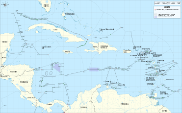
Island groups
Lucayan Archipelago[lower-alpha 1]
- Hispaniola
- Leeward Islands
- Saint Martin, politically divided between


- Windward Islands
- Leeward Antilles
Historical groupings
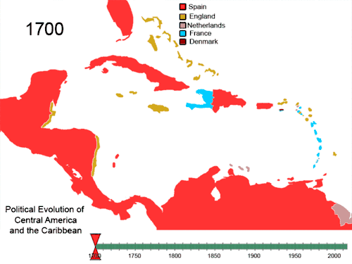

All islands at some point were, and a few still are, colonies of European nations; a few are overseas or dependent territories:
- British West Indies/Anglophone Caribbean – Anguilla, Antigua and Barbuda, Bahamas, Barbados, Bay Islands, Guyana, Belize, British Virgin Islands, Cayman Islands, Dominica, Grenada, Jamaica, Montserrat, Saint Croix (briefly), Saint Kitts and Nevis, Saint Lucia, Saint Vincent and the Grenadines, Trinidad and Tobago (from 1797) and the Turks and Caicos Islands
- Danish West Indies – Possession of Denmark-Norway before 1814, then Denmark, present-day United States Virgin Islands
- Dutch West Indies – Aruba, Bonaire, Curaçao, Saba, Sint Eustatius, Sint Maarten, Bay Islands (briefly), Saint Croix (briefly), Tobago, Surinam and Virgin Islands
- French West Indies – Anguilla (briefly), Antigua and Barbuda (briefly), Dominica, Dominican Republic (briefly), Grenada, Haiti (formerly Saint-Domingue), Montserrat (briefly), Saint Lucia, Saint Vincent and the Grenadines, Sint Eustatius (briefly), Sint Maarten, St. Kitts (briefly), Tobago (briefly), Saint Croix, the current French overseas départements of French Guiana, Martinique and Guadeloupe (including Marie-Galante, La Désirade and Les Saintes), the current French overseas collectivities of Saint Barthélemy and Saint Martin
- Portuguese West Indies – present-day Barbados, known as Os Barbados in the 16th century when the Portuguese claimed the island en route to Brazil. The Portuguese left Barbados abandoned in 1533, nearly a century before the British arrived.
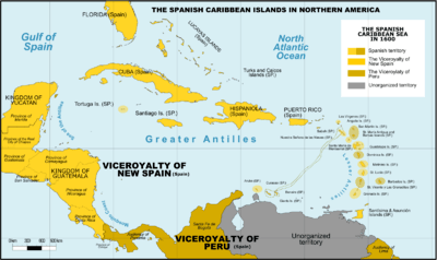
- Spanish West Indies – Cuba, Hispaniola (present-day Dominican Republic, Haiti (until 1659 to France), Puerto Rico, Jamaica (until 1655 to Great Britain), the Cayman Islands (until 1670 to Great Britain) Trinidad (until 1797 to Great Britain) and Bay Islands (until 1643 to Great Britain), coastal islands of Central America (except Belize), and some Caribbean coastal islands of Panama, Colombia, Mexico, and Venezuela.
- Swedish West Indies – present-day French Saint-Barthélemy, Guadeloupe (briefly) and Tobago (briefly).
- Courlander West Indies – Tobago (until 1691)
The British West Indies were united by the United Kingdom into a West Indies Federation between 1958 and 1962. The independent countries formerly part of the B.W.I. still have a joint cricket team that competes in Test matches, One Day Internationals and Twenty20 Internationals. The West Indian cricket team includes the South American nation of Guyana, the only former British colony on the mainland of that continent.
In addition, these countries share the University of the West Indies as a regional entity. The university consists of three main campuses in Jamaica, Barbados and Trinidad and Tobago, a smaller campus in the Bahamas and Resident Tutors in other contributing territories such as Trinidad.
Countries and territories of the Caribbean today

Continental countries with Caribbean coastlines and islands
|
|
Biodiversity
The Caribbean islands are remarkable for the diversity of their animals, fungi and plants, and have been classified as one of Conservation International's biodiversity hotspots because of their exceptionally diverse terrestrial and marine ecosystems, ranging from montane cloud forests to cactus scrublands. The region also contains about 8% (by surface area) of the world's coral reefs[38] along with extensive seagrass meadows,[39] both of which are frequently found in the shallow marine waters bordering the island and continental coasts of the region.
For the fungi, there is a modern checklist based on nearly 90,000 records derived from specimens in reference collections, published accounts and field observations.[40] That checklist includes more than 11250 species of fungi recorded from the region. As its authors note, the work is far from exhaustive, and it is likely that the true total number of fungal species already known from the Caribbean is higher. The true total number of fungal species occurring in the Caribbean, including species not yet recorded, is likely far higher given the generally accepted estimate that only about 7% of all fungi worldwide have been discovered.[41] Though the amount of available information is still small, a first effort has been made to estimate the number of fungal species endemic to some Caribbean islands. For Cuba, 2200 species of fungi have been tentatively identified as possible endemics of the island;[42] for Puerto Rico, the number is 789 species;[43] for the Dominican Republic, the number is 699 species;[44] for Trinidad and Tobago, the number is 407 species.[45]
Many of the ecosystems of the Caribbean islands have been devastated by deforestation, pollution, and human encroachment. The arrival of the first humans is correlated with extinction of giant owls and dwarf ground sloths.[46] The hotspot contains dozens of highly threatened animals (ranging from birds, to mammals and reptiles), fungi and plants. Examples of threatened animals include the Puerto Rican amazon, two species of solenodon (giant shrews) in Cuba and the Hispaniola island, and the Cuban crocodile.

The region's coral reefs, which contain about 70 species of hard corals and between 500–700 species of reef-associated fishes[47] have undergone rapid decline in ecosystem integrity in recent years, and are considered particularly vulnerable to global warming and ocean acidification.[48] According to a UNEP report, the Caribbean coral reefs might get extinct in next 20 years due to population explosion along the coast lines, overfishing, the pollution of coastal areas and global warming.[49]
Some Caribbean islands have terrain that Europeans found suitable for cultivation for agriculture. Tobacco was an important early crop during the colonial era, but was eventually overtaken by sugarcane production as the region's staple crop. Sugar was produced from sugarcane for export to Europe. Cuba and Barbados were historically the largest producers of sugar. The tropical plantation system thus came to dominate Caribbean settlement. Other islands were found to have terrain unsuited for agriculture, for example Dominica, which remains heavily forested. The islands in the southern Lesser Antilles, Aruba, Bonaire and Curaçao, are extremely arid, making them unsuitable for agriculture. However, they have salt pans that were exploited by the Dutch. Sea water was pumped into shallow ponds, producing coarse salt when the water evaporated.[50]
The natural environmental diversity of the Caribbean islands has led to recent growth in eco-tourism. This type of tourism is growing on islands lacking sandy beaches and dense human populations.[51]
Plants and animals
.jpg) Epiphytes (bromeliads, climbing palms) in the rainforest of Dominica.
Epiphytes (bromeliads, climbing palms) in the rainforest of Dominica. A green and black poison frog, Dendrobates auratus
 Caesalpinia pulcherrima, Guadeloupe.
 Costus speciosus, a marsh plant, Guadeloupe.
.jpg) An Atlantic ghost crab (Ocypode quadrata) in Martinique.
An Atlantic ghost crab (Ocypode quadrata) in Martinique. Crescentia cujete, or calabash fruit, Martinique.
_juvenile_yellow_stage_over_Bispira_brunnea_(Social_Feather_Duster_Worms).jpg) Thalassoma bifasciatum (bluehead wrasse fish), over Bispira brunnea (social feather duster worms).
Thalassoma bifasciatum (bluehead wrasse fish), over Bispira brunnea (social feather duster worms)..jpg) Two Stenopus hispidus (banded cleaner shrimp) on a Xestospongia muta (giant barrel sponge).
Two Stenopus hispidus (banded cleaner shrimp) on a Xestospongia muta (giant barrel sponge)._pair.jpg) A pair of Cyphoma signatum (fingerprint cowry), off coastal Haiti.
A pair of Cyphoma signatum (fingerprint cowry), off coastal Haiti. The Martinique amazon, Amazona martinicana, is an extinct species of parrot in the family Psittacidae.
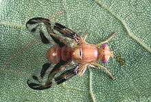 Anastrepha suspensa, a Caribbean fruit fly.
.jpg) Hemidactylus mabouia, a tropical gecko, in Dominica.
Hemidactylus mabouia, a tropical gecko, in Dominica.
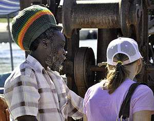
Demographics

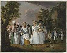
_(5981599576).jpg)
At the time of European contact, the dominant ethnic groups in the Caribbean included the Taíno of the Greater Antilles and northern Lesser Antilles, the Island Caribs of the southern Lesser Antilles, and smaller distinct groups such as the Guanajatabey of western Cuba and the Ciguayo of eastern Hispaniola. The population of the Caribbean is estimated to have been around 750,000 immediately before European contact, although lower and higher figures are given. After contact, social disruption and epidemic diseases such as smallpox and measles (to which they had no natural immunity)[52] led to a decline in the Amerindian population.[53] From 1500 to 1800 the population rose as slaves arrived from West Africa[54] such as the Kongo, Igbo, Akan, Fon and Yoruba as well as military prisoners from Ireland, who were deported during the Cromwellian reign in England. Immigrants from Britain, Italy, France, Spain, the Netherlands, Portugal and Denmark also arrived, although the mortality rate was high for both groups.[55]
The population is estimated to have reached 2.2 million by 1800.[56] Immigrants from India, China, Indonesia, and other countries arrived in the mid-19th century as indentured servants.[57] After the ending of the Atlantic slave trade, the population increased naturally.[58] The total regional population was estimated at 37.5 million by 2000.[59]
In Haiti and most of the French, Anglophone and Dutch Caribbean, the population is predominantly of African origin; on many islands there are also significant populations of mixed racial origin (including Mulatto-Creole, Dougla, Mestizo, Quadroon, Cholo, Castizo, Criollo, Zambo, Pardo, Asian Latin Americans, Chindian, Cocoa panyols, and Eurasian), as well as populations of European ancestry: Dutch, English, French, Italian, Portuguese and Spanish ancestry. Asians, especially those of Chinese, Indian descent, and Javenese Indonesians, form a significant minority in parts of the region. Indians form a plurality of the population in Trinidad and Tobago, Guyana, and Suriname. Most of their ancestors arrived in the 19th century as indentured laborers.
The Spanish-speaking Caribbean populations are primarily of European, African, or racially mixed origins. Puerto Rico has a European majority with a mixture of European-African-Native American (tri-racial), and a large Mulatto (European-West African) and West African minority. Cuba also has a European majority, along with a significant population of African ancestry. The Dominican Republic has the largest mixed-race population, primarily descended from Europeans, West Africans, and Amerindians.

Jamaica has a large African majority, in addition to a significant population of mixed racial background, and has minorities of Chinese, Europeans, Indians, Latinos, Jews, and Arabs. This is a result of years of importation of slaves and indentured laborers, and migration. Most multi-racial Jamaicans refer to themselves as either mixed race or brown. Similar populations can be found in the Caricom states of Belize, Guyana and Trinidad and Tobago. Trinidad and Tobago has a multi-racial cosmopolitan society due to the arrivals of Africans, Indians, Chinese, Arabs, Jews, Spanish, Portuguese, and Europeans along with the Native Amerindians population. This multi-racial mix has created sub-ethnicities that often straddle the boundaries of major ethnicities and include Dougla, Chindian, Mulatto-Creole, Afro-Asians, Eurasian, Cocoa panyols, and Asian Latin Americans
Indigenous groups
Language
Spanish, English, French, Dutch, Haitian Creole, and Papiamento are the predominant official languages of various countries in the region, although a handful of unique creole languages or dialects can also be found in virtually every Caribbean country. Other languages such as Caribbean Hindustani, Chinese, Indonesian, Amerindian languages, other African languages, other European languages, other Indian languages, and other Indonesian languages can also be found.
Religion
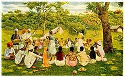
.jpg)
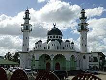


Christianity is the predominant religion in the Caribbean (84.7%).[60] Other religious groups in the region are Hinduism, Islam, Judaism, Rastafarianism, Buddhism, Chinese folk religion (Taoism and Confucianism), Bahá'í, Jainism, Sikhism, Zorastrianism, Kebatinan, Traditional African religions, Afro-American religions, Yoruba (Santería, Trinidad Orisha, Palo, Umbanda, Brujería, Hoodoo, Candomblé, Quimbanda, Orisha, Xangô de Recife, Xangô do Nordeste, Comfa, Espiritismo, Santo Daime, Obeah, Candomblé, Abakuá, Kumina, Winti, Sanse, Cuban Vodú, Dominican Vudú, Louisiana Voodoo, Haitian Vodou, and Vodun).
Politics
Regionalism
Caribbean societies are very different from other Western societies in terms of size, culture, and degree of mobility of their citizens.[61] The current economic and political problems the states face individually are common to all Caribbean states. Regional development has contributed to attempts to subdue current problems and avoid projected problems. From a political and economic perspective, regionalism serves to make Caribbean states active participants in current international affairs through collective coalitions. In 1973, the first political regionalism in the Caribbean Basin was created by advances of the English-speaking Caribbean nations through the institution known as the Caribbean Common Market and Community (CARICOM)[62] which is located in Guyana.
Certain scholars have argued both for and against generalizing the political structures of the Caribbean. On the one hand the Caribbean states are politically diverse, ranging from communist systems such as Cuba toward more capitalist Westminster-style parliamentary systems as in the Commonwealth Caribbean. Other scholars argue that these differences are superficial, and that they tend to undermine commonalities in the various Caribbean states. Contemporary Caribbean systems seem to reflect a "blending of traditional and modern patterns, yielding hybrid systems that exhibit significant structural variations and divergent constitutional traditions yet ultimately appear to function in similar ways."[63] The political systems of the Caribbean states share similar practices.
The influence of regionalism in the Caribbean is often marginalized. Some scholars believe that regionalism cannot exist in the Caribbean because each small state is unique. On the other hand, scholars also suggest that there are commonalities amongst the Caribbean nations that suggest regionalism exists. "Proximity as well as historical ties among the Caribbean nations has led to cooperation as well as a desire for collective action."[64] These attempts at regionalization reflect the nations' desires to compete in the international economic system.[64]
Furthermore, a lack of interest from other major states promoted regionalism in the region. In recent years the Caribbean has suffered from a lack of U.S. interest. "With the end of the Cold War, U.S. security and economic interests have been focused on other areas. As a result there has been a significant reduction in U.S. aid and investment to the Caribbean."[65] The lack of international support for these small, relatively poor states, helped regionalism prosper.
Following the Cold War another issue of importance in the Caribbean has been the reduced economic growth of some Caribbean States due to the United States and European Union's allegations of special treatment toward the region by each other.
United States effects on regionalism
The United States under President Bill Clinton launched a challenge in the World Trade Organization against the EU over Europe's preferential program, known as the Lomé Convention, which allowed banana exports from the former colonies of the Group of African, Caribbean and Pacific states (ACP) to enter Europe cheaply.[66] The World Trade Organization sided in the United States' favour and the beneficial elements of the convention to African, Caribbean and Pacific states has been partially dismantled and replaced by the Cotonou Agreement.[67]
During the US/EU dispute, the United States imposed large tariffs on European Union goods (up to 100%) to pressure Europe to change the agreement with the Caribbean nations in favour of the Cotonou Agreement.[68]
Farmers in the Caribbean have complained of falling profits and rising costs as the Lomé Convention weakens. Some farmers have faced increased pressure to turn towards the cultivation of illegal drugs, which has a higher profit margin and fills the sizable demand for these illegal drugs in North America and Europe.[69][70]
Caribbean Financial Action Task Force and Association of Caribbean States
Caribbean nations have also started to more closely cooperate in the Caribbean Financial Action Task Force and other instruments to add oversight of the offshore industry. One of the most important associations that deal with regionalism amongst the nations of the Caribbean Basin has been the Association of Caribbean States (ACS). Proposed by CARICOM in 1992, the ACS soon won the support of the other countries of the region. It was founded in July 1994. The ACS maintains regionalism within the Caribbean on issues unique to the Caribbean Basin. Through coalition building, like the ACS and CARICOM, regionalism has become an undeniable part of the politics and economics of the Caribbean. The successes of region-building initiatives are still debated by scholars, yet regionalism remains prevalent throughout the Caribbean.
Venezuela's effects on regionalism
The President of Venezuela, Hugo Chavez launched an economic group called the Bolivarian Alliance for the Americas (ALBA), which several eastern Caribbean islands joined. In 2012, the nation of Haiti, with 9 million people, became the largest CARICOM nation that sought to join the union.[71]
Regional institutions
Here are some of the bodies that several islands share in collaboration:
- Association of Caribbean States (ACS), Trinidad and Tobago
- Caribbean Association of Industry and Commerce (CAIC), Trinidad and Tobago
- Caribbean Association of National Telecommunication Organizations (CANTO), Trinidad and Tobago[72]
- Caribbean Community (CARICOM), Guyana
- Caribbean Development Bank (CDB), Barbados
- Caribbean Disaster Emergency Management Agency (CDERA), Barbados
- Caribbean Educators Network[73]
- Caribbean Electric Utility Services Corporation (CARILEC), Saint Lucia[74]
- Caribbean Examinations Council (CXC), Barbados and Jamaica
- Caribbean Financial Action Task Force (CFATF), Trinidad and Tobago
- Caribbean Food Crops Society, Puerto Rico
- Caribbean Football Union (CFU), Jamaica
- Caribbean Hotel & Tourism Association (CHTA), Florida and Puerto Rico[75]
- Caribbean Initiative (Initiative of the IUCN)
- Caribbean Programme for Economic Competitiveness (CPEC), Saint Lucia
- Caribbean Regional Environmental Programme (CREP), Barbados[76]
- Caribbean Regional Fisheries Mechanism (CRFM), Belize[77]
- Caribbean Regional Negotiating Machinery (CRNM), Barbados and Dominican Republic[78]
- Caribbean Telecommunications Union (CTU), Trinidad and Tobago
- Caribbean Tourism Organization (CTO), Barbados
- Community of Latin American and Caribbean States (CELAC)
- Foundation for the Development of Caribbean Children, Barbados
- Latin America and Caribbean Network Information Centre (LACNIC), Brazil and Uruguay
- Latin American and the Caribbean Economic System, Venezuela
- Organisation of Eastern Caribbean States (OECS), Saint Lucia
- United Nations Economic Commission for Latin America and the Caribbean (ECLAC), Chile and Trinidad and Tobago
- University of the West Indies, Jamaica, Barbados, Trinidad and Tobago.[79] In addition, the fourth campus, the Open Campus was formed in June 2008 as a result of an amalgamation of the Board for Non-Campus Countries and Distance Education, Schools of Continuing Studies, the UWI Distance Education Centres and Tertiary Level Units. The Open Campus has 42 physical sites in 16 Anglophone caribbean countries.
- West Indies Cricket Board, Antigua and Barbuda[80]
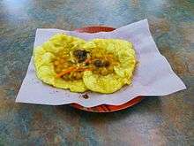
Cuisine
Favorite or national dishes

- Anguilla – rice, peas and fish
- Antigua and Barbuda – fungee and pepperpot
- Bahamas - Guava duff, Conch Salad, Peas n' Rice, and Conch Fritters
- Barbados – cou-cou and flying fish
- Belize - rice and beans, stew chicken with potato salad ; white rice, stew beans and fry fish with cole slaw
- British Virgin Islands – fish and fungee
- Cayman Islands – turtle stew, turtle steak, grouper
- Colombian Caribbean – rice with coconut milk, arroz con pollo, sancocho, Arab cuisine (due to the large Arab population)
- Cuba – platillo Moros y Cristianos, ropa vieja, lechon, maduros, ajiaco
- Dominica – mountain chicken, rice and peas, dumplings, saltfish, dashin, bakes (fried dumplings), coconut confiture, curry goat, cassava farine, oxtail
- Dominican Republic – arroz con pollo with stewed red kidney beans, pan fried or braised beef, salad/ ensalada de coditos, empanadas, mangú, sancocho
- Grenada – oil down,Roti and rice & chicken
- Guyana – pepperpot, cookup rice, roti and curry, methem, pholourie
- Haiti – griot (fried pork) served with du riz a pois or diri ak pwa (rice and beans)
- Jamaica – ackee and saltfish, callaloo, jerk chicken, curry chicken
- Montserrat – Goat water
- Puerto Rico – yellow rice with green pigeon peas, saltfish stew, roasted pork shoulder, chicken fricassée, mofongo, tripe soup, alcapurria, coconut custard, rice pudding, guava turnovers, Mallorca bread
- Saint Kitts and Nevis – goat water, coconut dumplings, spicy plantain, saltfish, breadfruit
- Saint Lucia – callaloo, dal roti, dried and salted cod, green bananas, rice and beans
- Saint Vincent and the Grenadines – roasted breadfruit and fried jackfish
- Suriname – brown beans and rice, roti and curry, peanut soup, battered fried plantain with peanut sauce, nasi goreng, moksie alesi, bara, pom
- Trinidad and Tobago – callaloo, doubles, aloo pie, phulourie, bake and shark, curry with roti or dal bhat, curry crab and dumpling
- United States Virgin Islands – stewed goat, oxtail or beef, seafood, callaloo, fungee
See also
- African diaspora
- Anchor coinage
- British African-Caribbean people
- British Indo-Caribbean people
- CONCACAF
- Council on Hemispheric Affairs
- Culture of the Caribbean
- Economy of the Caribbean
- Indian diaspora
- Indo-Caribbean
- Indo-Caribbean American
- List of Caribbean music genres
- List of sovereign states and dependent territories in the Caribbean
- NECOBELAC Project
- Non-resident Indian and person of Indian origin
- Piracy in the Caribbean
- Politics of the Caribbean
- Tourism in the Caribbean
Geography:
Notes
- ↑ The Lucayan Archipelago is excluded from some definitions of "Caribbean" and instead classified as Atlantic; this is primarily a geological rather than cultural or environmental distinction.
References
- 1 2 "World Population Prospects: The 2017 Revision". ESA.UN.org (custom data acquired via website). United Nations Department of Economic and Social Affairs, Population Division. Retrieved 10 September 2017.
- ↑ McWhorter, John H. (2005). Defining Creole. Oxford University Press US. p. 379. ISBN 0-19-516670-1.
- 1 2 Allsopp, Richard; Allsopp, Jeannette (2003). Dictionary of Caribbean English Usage. University of the West Indies Press. p. 136–. ISBN 978-976-640-145-0.
- ↑ Engerman, Stanley L. (2000). "A Population History of the Caribbean". In Haines, Michael R.; Steckel, Richard Hall. A Population History of North America. Cambridge University Press. pp. 483–528. ISBN 0-521-49666-7. OCLC 41118518.
- ↑ Hillman, Richard S.; D'Agostino, Thomas J., eds. (2003). Understanding the contemporary Caribbean. London, UK: Lynne Rienner. ISBN 158826663X. OCLC 300280211.
- ↑ Asann, Ridvan (2007). A Brief History of the Caribbean (Revised ed.). New York: Facts on File, Inc. p. 3. ISBN 0-8160-3811-2.
- ↑ Higman, B. W. (2011). A ConciseHistory of the Caribbean. Cambridge: Cambridge University Press. p. xi. ISBN 0521043484.
- ↑ Standard Country and Area Codes Classifications (M49), United Nations Statistics Division
- ↑ North America Atlas National Geographic
- ↑ "North America" Archived March 3, 2008, at the Wayback Machine. Atlas of Canada
- ↑ "North America". Britannica Concise Encyclopedia; "... associated with the continent is Greenland, the largest island in the world, and such offshore groups as the Arctic Archipelago, the Bahamas, the Greater and Lesser Antilles, the Queen Charlotte Islands, and the Aleutian Islands."
- ↑ The World: Geographic Overview, The World Factbook, Central Intelligence Agency; "North America is commonly understood to include the island of Greenland, the isles of the Caribbean, and to extend south all the way to the Isthmus of Panama."
- ↑ The Netherlands Antilles: The joy of six, The Economist Magazine, April 29, 2010
- ↑ "Carib". Encyclopædia Britannica. Archived from the original on 2008-07-10. Retrieved 2008-02-20.
inhabited the Lesser Antilles and parts of the neighbouring South American coast at the time of the Spanish conquest.
- ↑ Elster, Charles Harrington. "Caribbean", from The Big Book of Beastly Mispronunciations. p.78. (2d ed. 2005)
- ↑ In the early 20th century, only the pronunciation with the primary stress on the third syllable was considered correct, according to Frank Horace Vizetelly, A Desk-Book of Twenty-five Thousand Words Frequently Mispronounced (Funk and Wagnalls, 1917), p. 233.
- ↑ Ladefoged, Peter; Johnstone, Keith (2011). A Course in Phonetics. Cengage Learning. pp. 86–. ISBN 978-1-4282-3126-9.
- ↑ Random House Dictionary
- ↑ American Heritage Dictionary
- ↑ Merriam Webster
- ↑ See, e.g., Elster, supra.
- 1 2 Oxford Online Dictionaries
- ↑ "Background of the business forum of the Greater Caribbean of the Association of Caribbean States (ACS)". Archived from the original on 2010-03-27. Retrieved 2009-05-05. . acs-aec.org
- ↑ ten Brink, Uri. "Puerto Rico Trench 2003: Cruise Summary Results". National Oceanic and Atmospheric Administration. Retrieved 2008-02-21.
- ↑ "Summary Climatological Normals 1981–2010" (PDF). Departamento Meteorologico Aruba. Retrieved 15 October 2012.
- ↑ "Climate Data Aruba". Departamento Meteorologico Aruba. Retrieved 15 October 2012.
- ↑ "Average Weather for Mayaguez, PR - Temperature and Precipitation". Weather.com. Retrieved 2012-06-07.
- ↑ "World Weather Information Service – Havana". Cuban Institute of Meteorology. June 2011. Retrieved 2010-06-26.
- ↑ "Casa Blanca, Habana, Cuba: Climate, Global Warming, and Daylight Charts and Data". Retrieved 2010-06-26.
- ↑ "SPP Background". CommerceConnect.gov. Security and Prosperity Partnership of North America. Archived from the original on 18 June 2008. Retrieved 14 November 2010.
- ↑ "Ecoregions of North America". United States Environmental Protection Agency. Retrieved 30 May 2011.
- ↑ "What's the difference between North, Latin, Central, Middle, South, Spanish and Anglo America?". About.com.
- ↑ Unless otherwise noted, land area figures are taken from "Demographic Yearbook—Table 3: Population by sex, rate of population increase, surface area and density" (PDF). United Nations Statistics Division. 2008. Retrieved 14 October 2010.
- ↑ Since the Lucayan Archipelago is located in the Atlantic Ocean rather than Caribbean Sea, the Bahamas are part of the West Indies but are not technically part of the Caribbean, although the United Nations groups them with the Caribbean.
- 1 2 3 Population estimates are taken from the Central Bureau of Statistics Netherlands Antilles. "Statistical information: Population". Government of the Netherlands Antilles. Archived from the original on 1 May 2010. Retrieved 14 October 2010.
- ↑ Because of ongoing activity of the Soufriere Hills volcano beginning in July 1995, much of Plymouth was destroyed and government offices were relocated to Brades. Plymouth remains the de jure capital.
- ↑ Since the Lucayan Archipelago is located in the Atlantic Ocean rather than Caribbean Sea, the Turks and Caicos Islands are part of the West Indies but are not technically part of the Caribbean, although the United Nations groups them with the Caribbean.
- ↑ Mark Spalding; Corinna Ravilious; Edmund Peter Green (10 September 2001). World Atlas of Coral Reefs. University of California Press. ISBN 978-0-520-23255-6. Retrieved 25 June 2012.
- ↑ Littler, D. and Littler, M. (2000) Caribbean Reef Plants. OffShore Graphics, Inc., ISBN 0967890101.
- ↑ Minter, D.W., Rodríguez Hernández, M. and Mena Portales, J. (2001) Fungi of the Caribbean. An annotated checklist. PDMS Publishing, ISBN 0-9540169-0-4.
- ↑ Kirk, P. M.; Ainsworth, Geoffrey Clough (2008). Ainsworth & Bisby's Dictionary of the Fungi. CABI. ISBN 978-0-85199-826-8.
- ↑ "Fungi of Cuba – potential endemics". cybertruffle.org.uk. Retrieved 2011-07-09.
- ↑ "Fungi of Puerto Rico – potential endemics". cybertruffle.org.uk. Retrieved 2011-07-09.
- ↑ "Fungi of the Dominican Republic – potential endemics". cybertruffle.org.uk. Retrieved 2011-07-09.
- ↑ "Fungi of Trinidad & Tobago – potential endemics". cybertruffle.org.uk. Retrieved 2011-07-09.
- ↑ "North American Extinctions v. World". Thegreatstory.org. Retrieved 2010-08-23.
- ↑ "Caribbean Coral Reefs". coral-reef-info.com.
- ↑ Hoegh-Guldberg, O.; Mumby, P. J.; Hooten, A. J.; Steneck, R. S.; Greenfield, P.; Gomez, E.; Harvell, C. D.; Sale, P. F.; et al. (2007). "Coral Reefs Under Rapid Climate Change and Ocean Acidification". Science. 318 (5857): 1737–42. doi:10.1126/science.1152509. PMID 18079392.
- ↑ "Caribbean coral reefs may disappear within 20 years: Report". IANS. news.biharprabha.com. Retrieved 3 July 2014.
- ↑ Rogoziński, Jan (2000). A Brief History of the Caribbean. Penguin. p. 65. ISBN 978-0-452-28193-6.
- ↑ Rogoziński, Jan (2000). A Brief History of the Caribbean. Penguin. p. 356. ISBN 978-0-452-28193-6.
- ↑ Byrne, Joseph Patrick (2008). Encyclopedia of Pestilence, Pandemics, and Plagues: A-M. ABC-CLIO. p. 413. ISBN 0-313-34102-8.
- ↑ Engerman, p. 486
- ↑ The Sugar Revolutions and Slavery, U.S. Library of Congress
- ↑ Engerman, pp. 488–492
- ↑ Engerman, Figure 11.1
- ↑ Engerman, pp. 501–502
- ↑ Engerman, pp. 504, 511
- ↑ Table A.2, Database documentation, Latin America and the Caribbean (LAC) Population Database, version 3, International Center for Tropical Agriculture, 2005. Accessed on line February 20, 2008.
- ↑ Christianity in its Global Context Archived 2013-08-15 at the Wayback Machine.
- ↑ Gowricharn, Ruben. Caribbean Transnationalism: Migration, Pluralization, and Social Cohesion, Lanham: Lexington Books, 2006. p. 5 ISBN 0-7391-1167-1
- ↑ Hillman, p. 150
- ↑ Hillman, p. 165
- 1 2 Serbin, Andres (1994). "Towards an Association of Caribbean States: Raising Some Awkward Questions". Journal of Interamerican Studies and World Affairs. 36 (4): 61–90. JSTOR 166319.
- ↑ Hillman, p. 123
- ↑ "The U.S.-EU Banana Agreement". Archived from the original on 2009-05-06. Retrieved 2008-11-23. See also: "Dominica: Poverty and Potential". BBC. 2008-05-16. Retrieved 2008-12-06.
- ↑ "WTO rules against EU banana import practices". Archived from the original on 2009-04-16. Retrieved 2008-11-23. . eubusiness.com (2007-11-29)
- ↑ "No truce in banana war". BBC News. 1999-03-08. Retrieved 2010-08-23.
- ↑ "World: Americas St Vincent hit by banana war". BBC News. 1999-03-13. Retrieved 2010-08-23.
- ↑ "Concern for Caribbean farmers". Bbc.co.uk. 2005-01-07. Retrieved 2010-08-23.
- ↑ Edmonds, Kevin (2012-03-06). "ALBA Expands its Allies in the Caribbean". Venezuela Analysis. Retrieved March 9, 2012.
- ↑ "CANTO Caribbean portal". Canto.org. Retrieved 2008-12-06.
- ↑ "Caribbean Educators Network". CEN. Retrieved 2008-12-06.
- ↑ "Carilec". Carilec.com. Retrieved 2008-12-06.
- ↑ "About Us". Caribbean Hotel & Tourism Association. Retrieved 17 June 2014.
- ↑ "Caribbean Regional Environmental Programme". Crepnet.net. Archived from the original on 2008-06-11. Retrieved 2008-12-06.
- ↑ "Caribbean Regional Fisheries Mechanism". Caricom-fisheries.com. Retrieved 2008-12-06.
- ↑ "Official website of the RNM". Crnm.org. Retrieved 2008-12-06.
- ↑ "University of the West Indies". Uwi.edu. Retrieved 2008-12-06.
- ↑ "West Indies Cricket Board WICB Official Website". Windiescricket.com. Retrieved 2008-12-06.
Bibliography
- Engerman, Stanley L. "A Population History of the Caribbean", pp. 483–528 in A Population History of North America Michael R. Haines and Richard Hall Steckel (Eds.), Cambridge University Press, 2000, ISBN 0-521-49666-7.
- Hillman, Richard S., and Thomas J. D'agostino, eds. Understanding the Contemporary Caribbean, London: Lynne Rienner, 2003 ISBN 1-58826-663-X.
Further reading
- Develtere, Patrick R. 1994. "Co-operation and development: With special reference to the experience of the Commonwealth Caribbean" ACCO, ISBN 90-334-3181-5
- Gowricharn, Ruben. Caribbean Transnationalism: Migration, Pluralization, and Social Cohesion. Lanham: Lexington Books, 2006.
- Henke, Holger, and Fred Reno, eds. Modern Political Culture in the Caribbean. Kingston: University of West Indies Press, 2003.
- Heuman, Gad. The Caribbean: Brief Histories. London: A Hodder Arnold Publication, 2006.
- de Kadt, Emanuel, (editor). Patterns of foreign influence in the Caribbean, Oxford University Press, 1972.
- Knight, Franklin W. The Modern Caribbean (University of North Carolina Press, 1989).
- Kurlansky, Mark. 1992. A Continent of Islands: Searching for the Caribbean Destiny. Addison-Wesley Publishing. ISBN 0-201-52396-5
- Langley, Lester D. The United States and the Caribbean in the Twentieth Century. London: University of Georgia Press, 1989.
- Maingot, Anthony P. The United States and the Caribbean: Challenges of an Asymmetrical Relationship. Westview Press, 1994.
- Palmie, Stephan, and Francisco A. Scarano, eds. The Caribbean: A History of the Region and Its Peoples (University of Chicago Press; 2011); 660 pp.; writings on the region since the pre-Columbia era.
- Ramnarine, Tina K. Beautiful Cosmos: Performance and Belonging in the Caribbean Diaspora. London, Pluto Press, 2007.
- Rowntree, Lester/Martin Lewis/Marie Price/William Wyckoff. Diversity Amid Globalization: World Regions, Environment, Development, 4th edition, 2008.
External links
- Caribbean at Curlie (based on DMOZ)
- Digital Library of the Caribbean
- Manioc, open access digital Library, books, images, conferences, articles about the Caribbean
- Federal Research Division of the U.S. Library of Congress: Caribbean Islands (1987)
- LANIC Caribbean country pages
- Caribe Books: publishing house in the Caribbean

Coordinates: 14°31′32″N 75°49′06″W / 14.52556°N 75.81833°W