Gairezi River
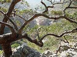
Miombo vegetation on the banks of the Gairezi, at Nyajiwa Falls
The Gairezi River has its origin in the Nyamaropa ward of the Nyanga highlands of eastern Zimbabwe. From the Eastern Highlands it flows northwards and for more than 60 km forms the border between Zimbabwe and Mozambique, before it enters Manica Province of Mozambique. Downstream of the Gairezi's confluence with the Ruenya River, it becomes the Luenha River, a tributary of the Zambezi.
The Gairezi's total length is more than 79 km, and it discharges 26,540 cubic centimeters of water per second. In places it is up to 56 metres wide, and 32 metres deep.
Coordinates: 17°20′43″S 33°03′08″E / 17.34528°S 33.05222°E
This article is issued from
Wikipedia.
The text is licensed under Creative Commons - Attribution - Sharealike.
Additional terms may apply for the media files.