Gaißa
| Gaißa | |
|---|---|
 | |
| Country | Germany |
| Physical characteristics | |
| Main source | Bavarian Forest |
| River mouth |
Danube 48°35′55″N 13°22′35″E / 48.59861°N 13.37639°ECoordinates: 48°35′55″N 13°22′35″E / 48.59861°N 13.37639°E |
| Length | 45.8 km (28.5 mi) |
| Basin features | |
| Progression | Danube→ Black Sea |
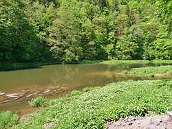
The Gaißa is a river in Bavaria, southeastern Germany, tributary of the Danube. It flows through the Bavarian Forest from North to South, crosses Aicha vorm Wald and joins the Danube northwest of Passau. The river reaches a length of 19.9 kilometres, but including its source river Große Ohe (not to be confused with the namesake tributary of the Ilz) it is 45.8 km long. Due to the nearby motorway much dirt was flushed into the water from time to time. Meanwhile its grade is B quality.
References
This article is issued from
Wikipedia.
The text is licensed under Creative Commons - Attribution - Sharealike.
Additional terms may apply for the media files.