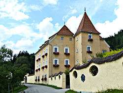
Gai, Styria
| Gai | ||
|---|---|---|
| part of Trofaiach | ||
 | ||
| ||
 Gai Location within Austria | ||
| Coordinates: 47°24′47.38″N 14°58′11.49″E / 47.4131611°N 14.9698583°ECoordinates: 47°24′47.38″N 14°58′11.49″E / 47.4131611°N 14.9698583°E | ||
| Country | Austria | |
| State | Styria | |
| District | Leoben | |
| Area | ||
| • Total | 3.48 km2 (1.34 sq mi) | |
| Elevation | 720 m (2,360 ft) | |
| Population (1-1-2012) | ||
| • Total | 80 | |
| • Density | 23/km2 (60/sq mi) | |
| Time zone | UTC+1 (CET) | |
| • Summer (DST) | UTC+2 (CEST) | |
| Postal code | 8793 | |
| Area codes | +43/3847 | |
| Vehicle registration | LN | |
| Website | www.gai.steiermark.at | |

Gai is a former municipality in the district of Leoben in the Austrian state of Styria. Since January 2013, it is part of the municipality Trofaiach.
Geography
Gai lies about 10 kilometres (6.2 mi) northwest of Leoben on the Styrian Eisenstraße, 3 km (1.9 mi) southwest of Trofaiach.
References
This article is issued from
Wikipedia.
The text is licensed under Creative Commons - Attribution - Sharealike.
Additional terms may apply for the media files.