Gabersdorf
| Gabersdorf | ||
|---|---|---|
| ||
 Gabersdorf Location within Austria | ||
| Coordinates: 46°46′56.5638″N 15°35′13.7898″E / 46.782378833°N 15.587163833°ECoordinates: 46°46′56.5638″N 15°35′13.7898″E / 46.782378833°N 15.587163833°E | ||
| Country | Austria | |
| State | Styria | |
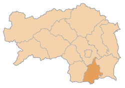
| District | Leibnitz | |
| Government | ||
| • Mayor | Franz Hierzer (ÖVP) | |
| Area | ||
| • Total | 19.81 km2 (7.65 sq mi) | |
| Elevation | 274 m (899 ft) | |
| Population (1 January 2016)[1] | ||
| • Total | 1,173 | |
| • Density | 59/km2 (150/sq mi) | |
| Time zone | UTC+1 (CET) | |
| • Summer (DST) | UTC+2 (CEST) | |
| Postal code | 8424 | |
| Area code | 03452 | |
| Vehicle registration | LB | |
| Website | www.gabersdorf.at | |

Gabersdorf is a municipality in the district of Leibnitz in the Austrian state of Styria.
Geography
Gabersdorf lies east of Leibnitz between the east Styrian hills and the Mur river.
References
This article is issued from
Wikipedia.
The text is licensed under Creative Commons - Attribution - Sharealike.
Additional terms may apply for the media files.