Inden
| Inden | ||
|---|---|---|
| ||
 Inden Location of Inden within Düren district 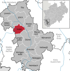  | ||
| Coordinates: 50°50′48″N 06°21′28″E / 50.84667°N 6.35778°ECoordinates: 50°50′48″N 06°21′28″E / 50.84667°N 6.35778°E | ||
| Country | Germany | |
| State | North Rhine-Westphalia | |
| Admin. region | Köln | |
| District | Düren | |
| Government | ||
| • Mayor | Ulrich Schuster | |
| Area | ||
| • Total | 35.92 km2 (13.87 sq mi) | |
| Elevation | 106 m (348 ft) | |
| Population (2016-12-31)[1] | ||
| • Total | 7,287 | |
| • Density | 200/km2 (530/sq mi) | |
| Time zone | CET/CEST (UTC+1/+2) | |
| Postal codes | 52459 | |
| Dialling codes | 02465 | |
| Vehicle registration | DN | |
| Website | www.inden.de | |
_COA.svg.png)
Inden is a municipality in the district of Düren in the state of North Rhine-Westphalia, Germany. It is located on the river Inde, approx. 10 km north-west of Düren. In the area around Inden lignite is extracted in open-pit mines. Several hundreds of inhabitants have been resettled in the 1990s and 2000s because of these activities.
Town division
Districts:
- Frenz
- Inden/Altdorf
- Lamersdorf
- Lucherberg
- Schophoven
- Viehöven
.jpg)
Inden-Schophoven Müllenark mill
Towns and municipalities in Düren (district) | ||
|---|---|---|
References
- ↑ "Amtliche Bevölkerungszahlen" (in German). Landesbetrieb Information und Technik NRW. Retrieved 2018-02-24.
This article is issued from
Wikipedia.
The text is licensed under Creative Commons - Attribution - Sharealike.
Additional terms may apply for the media files.