Frauenau Dam
| Frauenau Dam | |
|---|---|
 | |
| Official name | Trinkwassertalsperre Frauenau |
| Coordinates | 49°00′49″N 13°20′00″E / 49.0137°N 13.3334°ECoordinates: 49°00′49″N 13°20′00″E / 49.0137°N 13.3334°E |
| Construction began | 1976–1983 |
| Dam and spillways | |
| Impounds | Little Regen, Hirschbach |
| Height (foundation) | 84.7 or 86 m |
| Height (thalweg) | 70.5 m |
| Length | 640 m |
| Elevation at crest | 770.8 m[1] |
| Width (crest) | 9 m |
| Dam volume | 2.5 Mm³ |
| Reservoir | |
| Total capacity | 21.7 Mm³ |
| Active capacity | 20.8 Mm³ |
| Catchment area | 30.4 km² |
| Surface area | 94 ha |
| Normal elevation | 767 m |
| Power Station | |
| Installed capacity | 617 kW |
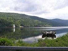
The Frauenau Dam (German: Trinkwassertalsperre Frauenau or Trinkwasserspeicher Frauenau) in the Bavarian Forest, was built in 1983 to ensure the drinking water supply to large parts of Lower Bavaria.
Description
Because there was a shortage of groundwater in the Bavarian Forest due to the geological situation there, in the years 1976 to 1983 a water storage reservoir was built near Frauenau and Zwiesel, that was fed by the Kleiner Regen and Hirschbach rivers which rose in the unsettled area on the Czech border between the Falkenstein and Rachel.
See also
References
Literature
External links
| Wikimedia Commons has media related to Trinkwassertalsperre Frauenau. |
- Archived 2007-09-28 at the Wayback Machine.
- Trinkwassertalsperre Frauenau - Stamm- und Qualitätsdaten (pdf file; 334 kB)
This article is issued from
Wikipedia.
The text is licensed under Creative Commons - Attribution - Sharealike.
Additional terms may apply for the media files.