Fläscherberg
| Fläscherberg | |
|---|---|
| Regitzer Spitz | |
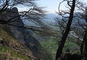 View from near the summit | |
| Highest point | |
| Elevation | 1,135 m (3,724 ft) |
| Prominence | 422 m (1,385 ft) [1] |
| Coordinates | 47°02′15″N 9°30′23″E / 47.03750°N 9.50639°ECoordinates: 47°02′15″N 9°30′23″E / 47.03750°N 9.50639°E |
| Geography | |
 Fläscherberg Location in Switzerland | |
| Location | Graubünden, Switzerland |
| Parent range | Rätikon |
The Fläscherberg (also known as Regitzer Spitz) is a mountain of the Rätikon, overlooking the Rhine in the Swiss canton of Graubünden. The closest locality is Fläsch on the southern side of the mountain.
References
External links
This article is issued from
Wikipedia.
The text is licensed under Creative Commons - Attribution - Sharealike.
Additional terms may apply for the media files.