Hintertaunus
| Hintertaunus | |
|---|---|
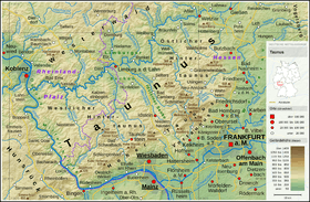 Taunus overview map
| |
| Highest point | |
| Peak | Weilsberg |
| Elevation | 700.7 m above NHN |
| Coordinates | 50°12′32.4″N 8°13′48.50″E / 50.209000°N 8.2301389°ECoordinates: 50°12′32.4″N 8°13′48.50″E / 50.209000°N 8.2301389°E |
| Dimensions | |
| Area | 1,816.67 km2 (701.42 sq mi) |
| Geography | |
| State | Hesse, Rhineland-Palatinate |
| Parent range | Taunus |
| Geology | |
| Orogeny | Low mountains |
| Type of rock | Devonian slate, Hunsrück slate (rock facies), greywacke, occasional basaltic rock, corallian limestone |
The Hintertaunus ("Farther Taunus") is a natural region in the German Central Upland range of the Taunus (major unit group 30), which rises to a height of 700.7 m above sea level (NHN)[1] and lies north of the High Taunus (301). It extends as far as the river Rhine to the west, the river Lahn to the north and the Wetterau hills to the east. It is divided into the Eastern Hintertaunus (major unit 302), Idstein Basin (303) and Western Hintertaunus (304).
External links

This article is issued from
Wikipedia.
The text is licensed under Creative Commons - Attribution - Sharealike.
Additional terms may apply for the media files.